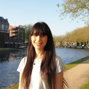
Foroughnia, F.
Profile
I received the B.S. degree in Geomatics and Geodesy Engineering in 2015, and the M.S. degree in Remote Sensing in 2018, both from K.N.Toosi University of Technology, Tehran, Iran. From 2018 to late 2019, I was a Research Assistant with the Department of Photogrammetry and Remote Sensing, K.N.Toosi University of Technology. I then started to work as a Researcher at Delft University of Technology, Department of Geoscience and Remote Sensing. Since June 2021, I have been a Ph.D. student at the Department of Geoscience and Engineering. My research interests include exploiting time series InSAR data for land subsidence monitoring and analysing EO data in other applications, like flood mapping.
Research
My Ph.D. research is mainly focused on assessing the building damages induced by earthquake-related land deformation.
- Foroughnia, F., Nemati, S., Maghsoudi, Y., & Perissin, D. (2019). An iterative PS-InSAR method for the analysis of large spatio-temporal baseline data stacks for land subsidence estimation. International Journal of Applied Earth Observation and Geoinformation, 74, 248-258.
- Tarighat, F., Foroughnia, F., & Perissin, D. (2021). Monitoring of power towers’ movement using persistent scatterer SAR interferometry in south west of Tehran. Remote Sensing, 13(3), 407.

Mahtab Foroughnia
PhD Candidate
- F.Foroughnia@tudelft.nl
-
Faculty of Civil Engineering and Geosciences
Building 23Room: 00.040
Department:
Geoscience and Engineering
Section:
Geo-Engineering