BSc education
The department Geoscience and Remote Sensing is responsible for several courses in the bachelor program of Civil Engineering, as well as in the bachelor program of Applied Earth Sciences.
Bachelor of Civil Engineering
In the bachelor of Civil Engineering we teach
- Surveying and Mapping (CTB3310 - 4EC, 3rd year)
- Climate Impacts and Engineering (CTB3311 - 4EC, 3rd year elective)
and contribute to
- Introduction to Civil Engineering (CTB1120 - 5EC, 1st year)
- Dynamics (CTB1210 - 5EC, 1st year)
- Bouwplaats (Construction Site) 2 (CTB2000-20 - 8EC, 2nd year)
- Monitoring and stabilityof dikes and embankments (CTB3425 - 4EC, 3rd year)
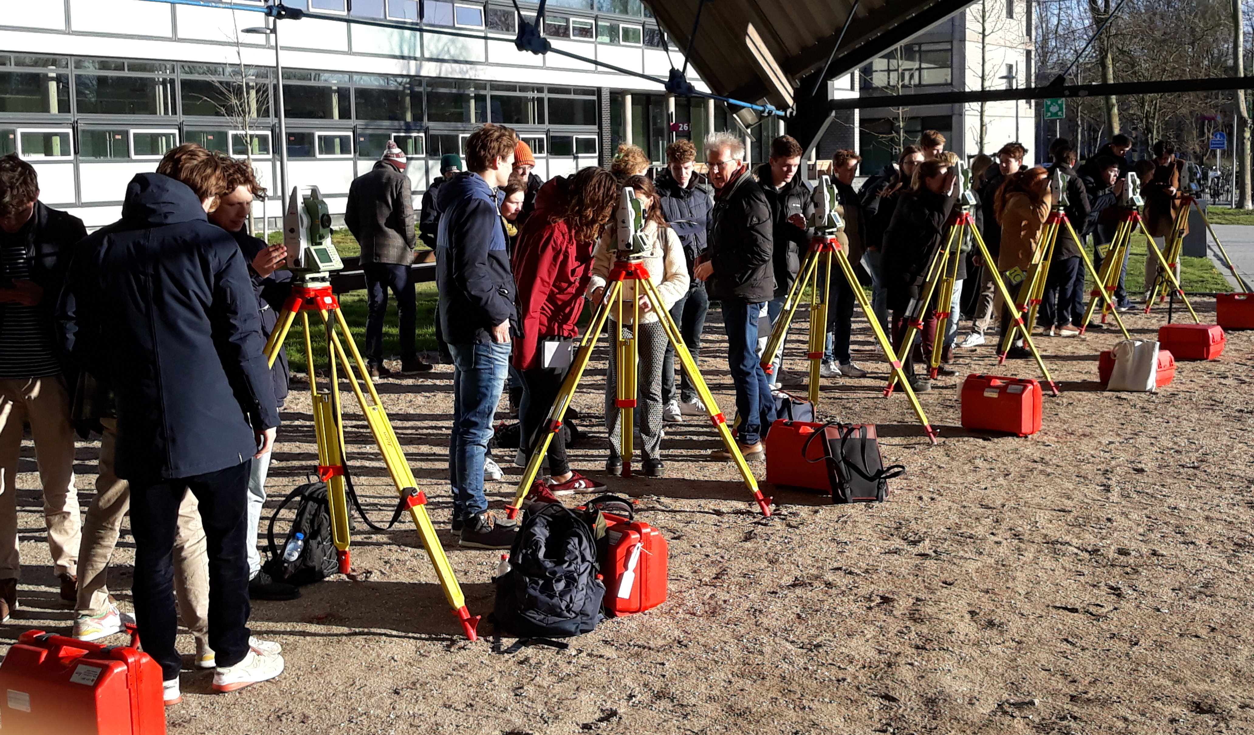
Land-surveying fieldwork on the TU Delft campus for 3rd year bachelor course CTB3310 Surveying and mapping
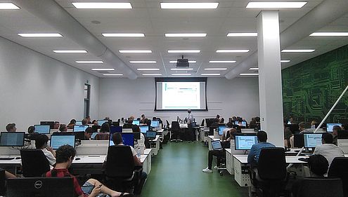
Programming instruction-session of the 2nd year bachelor course AESB2120 Systems and signals with Python.
Bachelor of Applied Earth Sciences
In the bachelor of Applied Earth Sciences we teach
- Mechanics (AESB1320-17 - 5EC, 1st year)
- Electricity and Magnetism (AESB1420-17 - 5EC, 1st year)
- Signals and Systems with Python (AESB2122 - 5EC, 2nd year)
- Chemical Thermodynamics (AESB2220-20 - 5EC, 2nd year)
- Geostatistics and Remote Sensing (AESB2440 - 5EC, 2nd year)
and contribute to
- Grand Challenges and Applied Earth Sciences (AESB1242 - 9EC, 1st year)
- Probability and Statistics (AESB1213 - 5EC, 1st year)
- Methodology of Geophysics and Remote Sensing (AESB1440-21 - 5EC, 1st year)
- Geological Fieldwork (AESB2430 - 5EC and AESB2431 - 5EC, 2nd year)
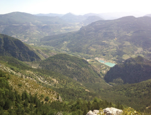
The second year BSc-course AESB2440 Geostatistics and Remote Sensing is connected to the Geological Fieldwork in the South-Eastern part of France. View from the top of the mountain over the La Motte-Chalancon area.
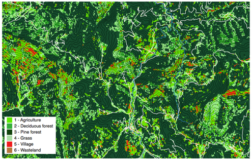
Classification map made by second year Applied Earth Sciences students during the fieldwork in France. In the field, students carry out a reconnaissance of the terrain, using also GPS-positioning. The resulting ground truth data are used for the purpose of training classification of remote sensing data, and a supervised classification of a Landsat-image of the area.
Course materials
Surveying and Mapping is the OPEN Textbook developed for the 3rd year bachelor cours on Surveying and Mapping and available at: https://textbooks.open.tudelft.nl/textbooks/%20catalog/book/46
