Open-source optical and SAR remoted sensing data as a drought indicator for grass covered dikes
By Denise Caljouw
Dikes, also called levees, embankments or dams, are man-made structures which play a major role in flood protection. The primary function of a dike is to hold back the water and protect the land behind it from. The function of dikes are becoming increasingly important as sea-level keeps rising, land subsides and extreme weather patterns increase due to climate change. With hundreds of millions of people around the world living in low elevation coastal zone (i.e. areas less than 10 metres above sea level), dikes are very crucial barriers.
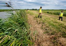
In the Netherlands dikes are visually monitored by inspectors who have a crucial role to find (potential) weaknesses in the dike. With 60% of the Netherlands below sea level these inspections are very important. Visual inspections are a slow, costly and time consuming process with about 22,500 kilometres of dike in the Netherlands. During an inspection, inspectors look at different quality indicators which could indicate a change or loss of the dike structure. There are dozens of parameters which have to be inspected such as quality of grass covers, deformations and saturation. The frequency of inspection differs per parameter and also depends on different type of factors such as the type of flood defense (primary or regional) and the probability of flooding.
One of the inspection parameters is the grass cover quality. Vegetation is highly responsive to changes in soil moisture and therefore monitoring vegetation condition is very valuable since it can be used as an indicator for subsurface conditions (Hopkins, 2009). Hasan et al. (2013) concluded that grass growing over areas with cracks and fractures was stressed or dying due to lack of moisture, while it grew green in adjacent areas. Jamalinia et al. (2019) has shown that there is a strong, lagged correlation between the leaf area index (LAI) and the water root zone content. Furthermore, a strong correlation between root zone water content and the factor of safety of a dike was found. As the amount of vegetation strongly affects the water flux into the dike and consequently impacts the factor of safety of a dike, vegetation could be used as an indicator to detect vulnerable dikes in the early stage. Cundill (2016) demonstrated that optical remote sensing imagery with a relatively lower spatial resolution (e.g. 2 meter) performed relatively well in finding a correlation between soil moisture and state of vegetation compared to high spatial resolution sensors. Illustrating the ability of vegetation indicators to give an indication of subsurface conditions. Several studies have also shown the potential of SAR data to map changes of surface soil moisture content over agricultural areas (Srivastava et al., 2006) (Balenzano et al., 2010) (Hasan et al., 2013).
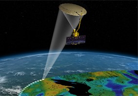
There is a clear need to continuously monitor the state of vegetation on levees not only in time but also spatially to make local inspections more effective. Mapping vegetation indices and backscatter obtained from optical and SAR remote sensing data could therefore be used to more continuously monitor on large scale and identify areas of interest for further investigation. Since vegetation health and the water root zone content are strongly correlated, vegetation indices and backscatter obtained from remote sensing could potentially give an indication of the stability of a dike. Open-source satellite missions like Sentinel-1, Sentinel-2 and Landsat 7 and 8 would be an ideal data source since it is freely available.
The objective of the thesis is to investigate if vegetation indices and backscatter obtained from open-source remote sensing data can be used as a drought indicator for grass covered dikes. This could facilitate dike inspections by more continuously monitoring the drought of dikes and making local inspections more effective, ensuring dike safety.