Groundwater recharge due to contour trenching in Phuoc Nam, Vietnam
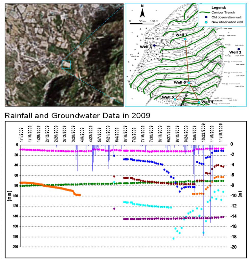
In 2007, contour trenching was tested in a semi arid area in Phuoc Nam, Vietnam. In 2008, the contribution of recharge at a contour trench plot was determined as potential and not quite visible. Recharge has not been confirmed, since groundwater level data at the contour trench plot were not available. To understand the recharge process at watershed scale, 4 new observation wells were installed on 8 hectares contour trench plot to assess the impact of the trenches to the groundwater system. This investigation was conducted during a single rainy season in 2009, shortly after the construction of the new observation wells. Annual rainfall reached 1303 mm, suggesting a rarely wet year. After 4 heavy rainfall events, runoff from uphill and outside the contour trench plot randomly filled up the trenches, yielded to roughly 4 times filling up the volume of the trenches. Ponding water infiltrated further in different temporal scale. Whilst at the same time, erosion occurred at the most uphill area, bringing along fine sediment towards the trenches. Tracer methods such as dye, salt and isotope technique were also used to confirm the infiltration process. MODHMS was used to simulate groundwater recharge at watershed scale. By combining the monitoring program, the tracer method and the hydrological modeling, we could get the first understanding of the local recharge process at a contour trench plot.