Good landscape design requires effective means for understanding and communicating about spatial features. PhD candidate Mei Liu developed analytical mapping methods to describe the spatial-visual characteristics of landscapes. These help designers to comprehend how a particular space is organised, and what ordering principles play a role in a balanced design.
A walk through Amsterdam’s Vondelpark shows that this city park, which opened in 1865, is in fact a succession of spaces featuring lawns, water features, and groups of trees in a certain rhythm. “When we analyse the architectonic compositions of the park, the underlying sequential experience emerges,” says Mei Liu. “If we can understand this, we can use it to evaluate whether specific design intentions have been achieved. The design process becomes verifiable.”
The central objective in the PhD research “Mapping landscape spaces” is intersubjectively interpreting landscape spaces and determining whether the spatial-visual characteristics are well constructed. Liu summarises the relevant design vocabulary in spatial-visual terms, such as “sequence”, “orientation”, “continuity”, and “complexity”. She uses a wide range of mapping techniques to analyse, interpret, and visualise them. This provides a factual basis for translating these abstract descriptions into real spatial-visual organisations.
Geodata
In her spatial analysis, the Chinese researcher closely studies the spatial and visual arrangements of landscape elements. Some spaces are open, others closed. This variety prevents the visitor walking through it from getting bored; a surprise might await at every turn.
The successful design of the Vondelpark may have been intuitive a century and a half ago, but techniques from the 21st century enable a detailed visibility analysis. Geodata and GIS platforms can be used to determine exactly how open or closed a landscape space is.
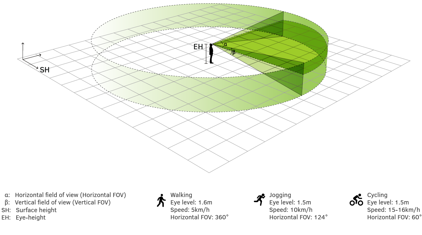
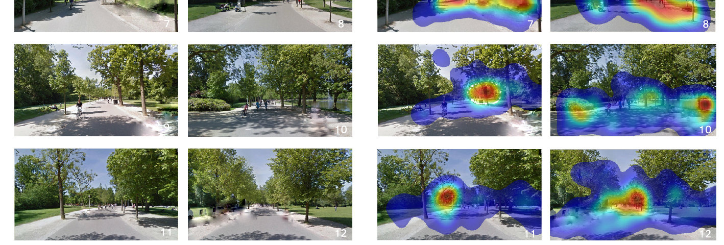
In a series of maps Liu made of the elongated Amsterdam city park, the very open spaces are coloured purple, the more closed parts are green or yellow. She used camera techniques to monitor what the visitor's eyes perceive and which elements attract attention. She also consulted photos, maps, drawings, and 3D models. This yields a complete picture of what the visitor experiences when walking through the park from different directions. “This allows for a better understanding of how the park is designed, what the visual quality is and why it works. Once that is understood, it can be applied elsewhere.”
Will this not result in there being Vondelparks everywhere? No, Liu emphasises, it is about the methods of analysis. They can help to create a design that meets the predetermined objectives and the challenges of a location.
Liu used different types of software tools to arrive at an integrated analysis. The most promising technique is probably point cloud modelling, but this requires a lot of computing power. If the computing power is available, though, the methods developed can also be used for analysis of flood risks and other dynamic systems. This can help to improve existing landscape designs without spatial qualities being lost. For example, it could be useful for necessary interventions necessitated by soil subsidence or climate change. Liu: "Mapping techniques can be a great aid in this."
Published: January 2021
More information
- PhD thesis 'Mapping landscape spaces'

