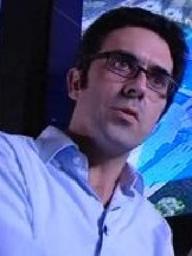
Prof.dr.ir. R.F. (Ramon) Hanssen
Profile
Ramon Hanssen is Antoni van Leeuwenhoek professor in Geodesy and Satellite Earth Observation. He studied aerospace engineering and geodetic engineering at Delft University of Technology (M.Sc. 1993). In 1994, he worked as a researcher on potential field data inversion at the International Institute for Aerospace Surveys and Earth Sciences (ITC). In 1995, he returned to TU Delft to start his PhD research on the geodetic analysis of repeat-pass spaceborne radar interferometry, with emphasis on error propagation. During this research, he worked as a visiting scholar at Stuttgart University (1996), at the German Aerospace Center (DLR, 1997) and at Stanford University (1997-1998) on a Fulbright research fellowship. In 2001 he received the PhD degree (cum laude). At present, he is working in the field of radar remote sensing, geodesy and geostatistics at the Faculty of Civil Engineering and Geosciences.
He received a Fulbright Fellowship in 1997, the Innovational Research Award (Vernieuwingsimpuls) from the Netherlands Organisation for Scientific Research (NWO) and the Bomford Prize of the International Association of Geodesy in 2003. In 2007 he was a visiting scholar at the Nordic Volcanological Institute of the University of Iceland. In 2008 he was awarded the Antoni van Leeuwenhoek chair of Delft University of Technology. In 2007 and 2008 he received the SBIR award from the Dutch Ministry of Economic Affairs for founding a TU Delft spin-off company for radar remote sensing and monitoring of water defence works, now known as SkyGeo.
Research themes
- Earth deformation
- Radar Remote Sensing
- Sea level and Climate Change
Research
Hanssen’s current research interests include the geodetic analysis of imaging remote sensing data, the influence of the atmosphere on space-geodetic techniques, and the mathematical modeling and physical interpretation of deformation processes. In 2001, he published a text book on Satellite Radar Interferometry, which is well recognized in the scientific community.
Publications
An overview of my publications can be found here, or via Pure, Google Scholar or ISI publications
Key publications:
- Hanssen, R.F., (2001) Radar Interferometry: Data Interpretation and Error Analysis. Kluwer Academic Publishers, Dordrecht, 328 pp. ISBN: 0-7923-6945-9 (>1500 citations)
- Hanssen, R.F., T.M.Weckwerth, H.A. Zebker, and R. Klees. (1999) High-resolution water vapor mapping from interferometric radar measurements. Science, 283:1295-1297. (>160 citations)
- Kampes, B.M., R.F. Hanssen, and Z. Perski, (2003) Radar interferometry with public domain tools, Proceedings of Fringe 2003, (>175 citations)
- Hanssen, R.F., (1998) Atmospheric heterogeneities in ERS tandem SAR interferometry, Delft University Press, Delft. 137 pp. ISBN: 90-407-1774-5 (>125 citations)
- Kampes, B.M., and R.F. Hanssen, (2004) Ambiguity Resolution for Permanent Scatterer Interferometry IEEE Transactions on Geoscience and Remote Sensing, 42(11):2446-2453. (>100 citations)
- Chang, L & Hanssen, RF (2014). Detection of cavity migration and sinkhole risk using radar interferometric time series. Remote Sensing of Environment, 147(5), 56-64. (10 citations)
- Zhu, X.X.; Montazeri, S.; Gisinger, C.; Hanssen, R.F.; Bamler, R., (2015) "Geodetic SAR Tomography," IEEE Transactions on Geoscience and Remote Sensing, , vol.PP, no.99, pp.1-18 doi: 10.1109/TGRS.2015.244868
- Mahapatra, P.S., S Samiei-Esfahany, RF Hanssen, Geodetic Network Design for InSAR, (2015) IEEE Transactions on Geoscience and Remote Sensing, 53 (7), 3669-3680
- Chang, L. and Hanssen, R.F., A Probabilistic Approach for InSAR Time-Series Postprocessing , IEEE Transactions on Geoscience and Remote Sensing, vol.PP, no.99, pp.1-10 doi: 10.1109/TGRS.2015.2459037
- Caro Cuenca, M, Hooper, AJ & Hanssen, RF (2013). Surface deformation induced by water influx in the abandoned coal mines in Limburg, The Netherlands observed by satellite radar interferometry. Journal of Applied Geophysics, 88(January 2013), 1-11.
- Berger, J Moreno, JA Johannessen, PF Levelt, RF Hanssen, (2012) ESA's sentinel missions in support of Earth system science, Remote Sensing of Environment 120, 84-90 (>50 citations)
- For more publications see Pure, Google Scholar or ISI publications
- Software: Delft Object-Oriented Radar Interferometric Software (DORIS) (co-developed with B. Kampes and the radar remote sensing group)
Information for prospective students (MSc or PhD)
If you are considering doing a BSc, MSc or PhD (thesis) project with prof. Hanssen, click here to retrieve more information on past, current, and future potential projects.
Educational activities
At TU Delft Hanssen has taught courses on Calculus of Observations, Radar Remote Sensing, Multivariate Data Analysis, Earth Observation, Instrument Analysis and Control, Geostatistics, Adjustment theory, Testing theory, Digital Terrain Modeling, Remote Sensing, Scientific Inferences and Deformation analysis.
He lectured courses for the European Space Agency (ESA) on radar in Hanoi (Vietnam), Prague, (Czech Republic), Alpbach (Austria), Buenos Aires (Argentina), Krakow (Poland), Lima (Peru), Valencia (Spain), Bucharest (Rumania).
For the IAG he taught at the International Centre for Theoretical Physics, Trieste, and lectured in Kyoto University, Middle East Technical University in Ankara, Sultan Qabooz University in Muscat (Oman), University of Miami, Tel Aviv, the Chinese Academy of Sciences, Beijing, University of Porto, and the University of Wuhan.
He lectured tutorials at the IEEE International Geoscience and Remote Sensing conference in Seoul, Korea.
Other key lectures include the ‘Huygens lecture’, 2014, the Hague, the ‘Baarda lecture’, 2014, Den Bosch; the Lely-lecture, 2007, Lelystad, and the Diligentia lecture, 2010, the Hague
Other activities
- Netherlands Center for Geodesy and Geoinformatics, (NCG) board member
- International Union of Geodesy and Geophysics, (IUGG) president of the national committee
- Council for Earth and Life Sciences, Royal Academy of Sciences, member
- SkyGeo, founder and principal scientist
- NCG Committee on Land Subsidence and Sea Level Change, chair
- SAR

Ramon Hanssen
Professor in Geodesy and Satellite Earth Observation
- +31 15 27 83662
- r.f.hanssen@tudelft.nl
-
Faculty of Civil Engineering and Geosciences
Building 23
Stevinweg 1 / PO box 5048
2628 CN Delft / 2600 GA Delft
Room number: 2.13
Download vcard (Outlook) Secretaries to prof. Hanssen: Secretariat GRS: secr-grs-citg@tudelft.nl Phone secretariat: +31 15 278 1701/3546
|