Unravelling Urban Cognition
Theory and Modelling of Acquiring and Storing Spatial Knowledge Resulting from Wayfinding Behaviour by Active Modes
Once Colin Ellard posed the question why we can find our why to the moon, but get lost in malls (or, in this case, cities). Equipped with the right information to orient and navigate we can explore the universe and expend our choice set. However, we know surprisingly little about what, where, and when information should be provided to tourists, newcomers, and during new traffic situations caused by road constructions or urban mass events. One of the reasons for this dyad is that we do not entirely understand from a behavioural and cognitive perspective how people find their way in urban environments. How do people utilize, acquire and memorize spatial knowledge (after Lynch idea about the imageable city: landmarks, paths, intersections, edges, and areas) along their way?
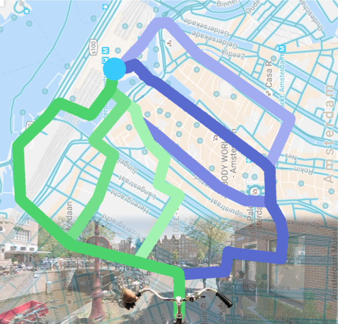
The bigger question that guides this research is how can we model the utilization, acquisition, and memorization of spatial knowledge by active modes (pedestrians and cyclists) on the urban environment they are moving in and investigate how ICT services, urban syntax, and social interactions impact this urban wayfinding behaviour.
Based on a variety of experiments (survey’s, simulations and empirical data analysis of GPS trajectories) more insight will be gained on the influence of salient landmarks and urban syntax, the complexity of the urban street network. These insights will be evaluate to what extend they can enrich travel information by assisting people to construct better orient and navigate in urban environments by measuring the impact on their cognitive representations of the city, and what effect that would have on their route choice behavior in urban environments.
Lara-Britt ZomerStart/end date: October 2015 – October 2019Daily supervisor: Oded Cats, Dorine Duives Promotor: Serge Hoogendoorn |