Remote Sensing
Remote sensing is broadly defined as the collection of information about an object without being in physical contact with it. In hydrology and earth sciences, it is typically used to describe data collected about the earth and its atmosphere using instruments onboard satellites. In hydrology, we mainly use measurements taken between visible (10 15 Hz) and microwave (10 9 Hz) frequencies to characterize and monitor the land surface.
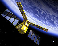
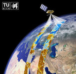
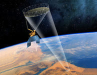
At Water Resources Management, we have a special interest in microwave remote sensing because it is used to observe soil moisture. Soil moisture is key to the coupling between the water and energy balances, so it is very important in hydrology and water resources management. There are two types of microwave instrument, and both can be used to measure soil moisture. In passive microwave remote-sensing, the energy emitted by the soil surface itself is collected at the instrument antenna. The amount of energy emitted depends, among other things, on the soil moisture. Observations from this type of instrument are often quite coarse (~40km from low earth orbit) because energy must be collected from a large area to generate a strong signal. ESA's Soil Moisture and Ocean Salinity (SMOS) is an example of a passive microwave remote-sensing satellite. In active remote sensing, microwaves are transmitted from the instrument and are scattered back to the instrument by the land surface. The "backscattered" signal depends on, among other things, the soil moisture. Soil moisture observations from radar remote-sensing are often at finer resolution (a few km), but typically have large errors associated with them.
SMOS | ERS/MetOP at TU Wien | SMAP | |
Source: www.cesbio.ups-tlse.fr | Source: www.ipf.tuwien.ac.at/radar/ | Source: smap.jpl.nasa.gov | |
Microwave satellite missions to measure soil moisture. (Click on images to visit homepages) | |||
Data from the visible, near-infrared and thermal ranges are also very useful. We often use data from the Moderate Resolution Imaging Spectroradiometer (MODIS) instrument on the Aqua and Terra satellites to determine land cover, vegetation indices, soil temperature and various parameters required by land surface models.
We also use data from the Gravity Recovery and Climate Experiment (GRACE) mission. GRACE consists of twin satellites launched in March 2002. The distance between the two satellites, as they are pushed and pulled by the Earth's gravitational field, is used to monitor anomalies in this field. In Water Resources Management, we are interested in the changes in Terrestrial Water Storage, which is a measure of all the water stored in the land surface.
Projects at Water Resources Management that involve remote sensing include:
- Vegetation: A novel soil moisture sensor?
- Assimilating GRACE terrestrial water storage data into a conceptual hydrology model for the River Rhine
If you are interested in working on this topic at Water Resources Management, please contact Susan Steele-Dunne or Nick van de Giesen.