Extended urbanisation in the North Sea
The North Sea is not only a huge body of water but also a site of unfolding urbanisation processes. Marie Curie Fellow Nancy Couling is mapping layers of different uses of the North Sea to illustrate the high levels of urbanisation.
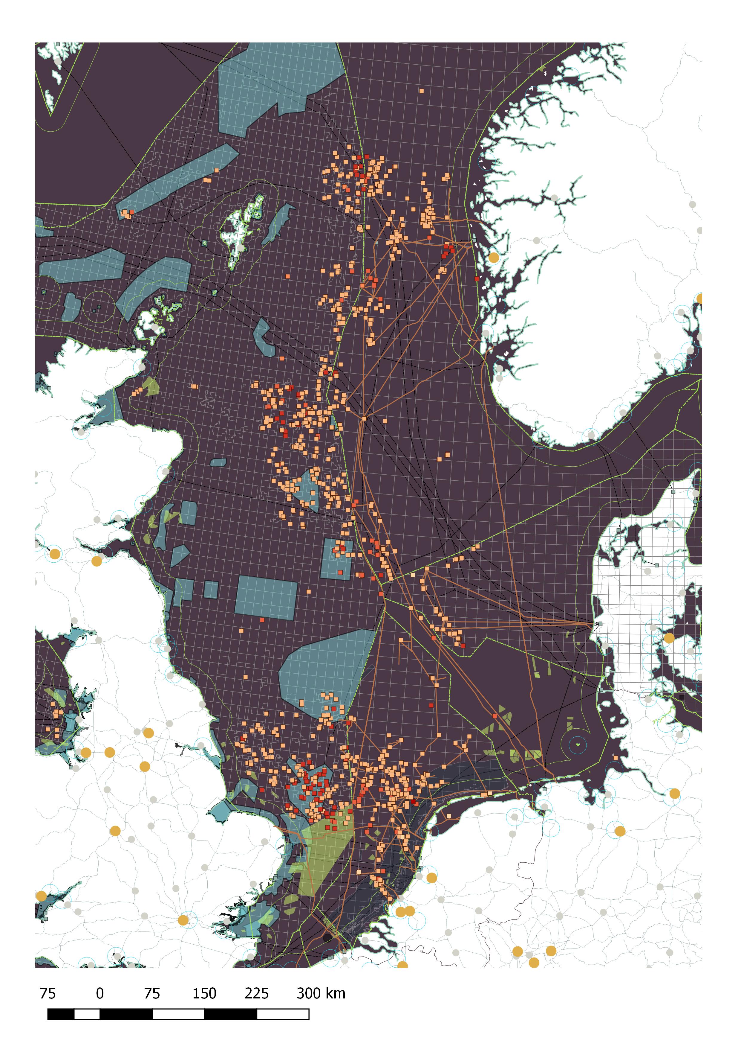
We tend to think that urban processes stop at the threshold between land and sea, but these processes continue, Couling states. Seas and oceans have become built environments. There are marked shipping lanes, pipelines, cables and drilling platforms. Most of them are not visible to the general public and are only accessible to specialists. In addition, there is a legal construct (United Nations Convention on the Law of the Sea) which divides the sea like a pie among littoral countries, thereby forming the grounds on which drilling licences are issued.
According to Couling, there is no central pool of knowledge for information on marine urbanisation and many people have identified it as a real issue. Professor Carola Hein (History of Architecture and Urban Planning) has done a project on mapping oil flows and the concomitant built environment to visualise the impact of petroleum over the last 150 years. “Understanding how oil flows have determined the sea space and are providing the framework for future development is a next step,” says Hein. “Wind farms at sea, for example, are competing with shipping lanes.”
Couling is looking at the bigger picture in her Oceanurb the unseen spaces of extended urbanisation in the North Sea project. She is gathering and putting together layers of different sea-uses. These layers will be open-source data. “TU Delft has a data bank and assists in the development of a data management plan for these layers.”
She looks at history and visits sites where interesting or conflictual developments are taking place that are new or emerging and are slowly changing the character of things on land. “It is about where the developments come back to land. How does wind farm development affect coastal ports or settlements? These are often very small places that are only changing incrementally.”
Last June, Hein and Couling held an interdisciplinary conference at TU Delft where Couling presented the results to date. Maps visualise what is normally unseen and demonstrate how the space of the North Sea is at a premium. “It needs to be negotiated and thought about very carefully,” she says.