Railway Bridge Concepcion
The Chilean railway company EFE is aiming to increase/maintain its share in cargo transportation in the country. In order to do so, they have to replace their outdated bridges. In this project the focus is placed on a bridge near the communities of Concepción, San Pedro de la Paz and Hualpén.
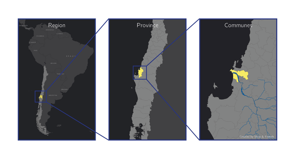
Figure 1 Biobío Region with the province of Concepción, with the communes Concepción
The EFE aims to have the bridge finished by 2022. However, since 2016, two bridges crossing the Biobío have collapsed, possibly due to the morphological chances of the river. In order to correctly assess the affects of the river on the substructure of the bridge, four students will travel to Chile to investigate the morphological and hydraulic effects of the river on the foundation of bridge. With the acquired results an initial design for the new railway bridge is made.
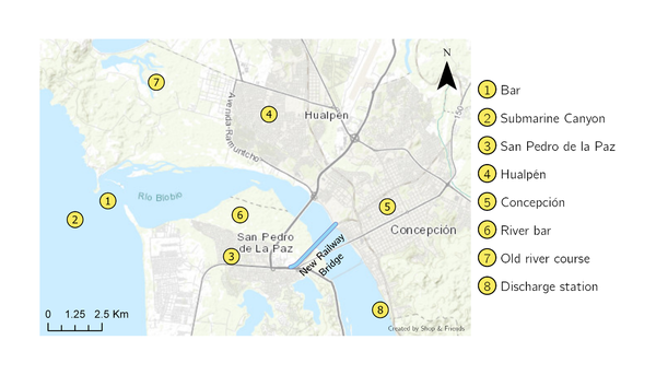
Figure 2 Overview of features in the region.
In order to reach the objective of the project several tools are utilised. As a starting point, the surroundings of the Biobío river are mapped. This is done through a regional and stakeholder analysis. Data collected and obtained through these analyses are stored in a GIS (Geographical Information System) environment. This tool is utilised to increase project understanding and make data easily accessible and understandable.
To investigate the morphodynamics of the river itself, a Delft3D model is created. This model is used to investigate the hydro- and morphodynamic changes of the river over time. By analysing the data from the computations performed in Delft3D, an insight in the development of the system over time can be achieved. With this insight the relevant physical processes in the Biobío river can be better understood. Furthermore, the Delft3D-suite can include river flood waves and tsunamis, which are both relevant natural disasters and their influence on the system cannot be neglected.
In addition to the Delft3D model, a NeoWave model is created to specifically assess the influence of a tsunami on the river and the bridge. The wave penetration could be plotted to assess whether the substructure of the bridge should be designed for tsunamis as well.
With the understanding of the system, a preliminary bridge design is proposed, the design is supported with a 3D model of the bridge and is integrated into the landscape. The usage of the different tools, and the connection between these tools results in an integrated project approach.
If you are interested to read more, please check out our website: www.pprb.nl.
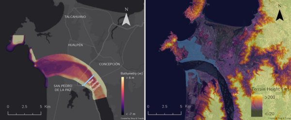
Figure 3 Bathymetry of the Biobío and on the right a flood from 2006.