Our Earth is changing due to the natural geophysical processes, climate change, land use, growing population and urbanisation. You may ask yourself:
How can we improve our understanding of the underlying processes?
How can we understand, monitor and predict geohazards and changes in our living environment?
How can we make the right decisions for the future?
What you will learn:
➨ Advanced remote sensing technologies ➨ Innovative data science and modelling techniques ➨ Measurement techniques such as imaging radar (including interferometry), optical and multi-spectral imaging, gravimetry, radiometry, altimetry, LiDAR, sonar, GNSS, electromagnetic exploration methods, and seismic exploration methods ➨ Measurement principles, sensors, and data acquisition techniques ➨ How to design and apply geo-data analysis methods and to exploit the data to address scientific and societal challenges related to for example geohazards and climate change
The discipline was a good fit for me as I could observe, model, and interpret larger-scale processes on Earth, like earthquakes and volcanic activities. Additionally, I’m able to investigate a variety of different topics, ranging from climate, geo-resources and energy, and the Earth’s structure and dynamics, which allows me to be flexible in my future career.
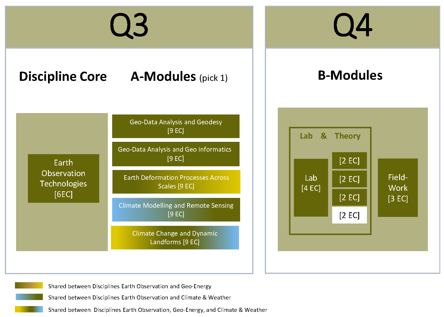
In Q3, you start the Earth Observation Discipline Core Module [6 ECS] simultaneously with one A-module [9 ECS] of your choice. Each A-module is divided into units which allows you to either dive further in the field of Earth Observation, or gain complementary competencies from the Disciplines Climate & Weather or Geo-Energy. In Q4 you follow B-Modules, gaining hands on experience in the lab and out in the field.
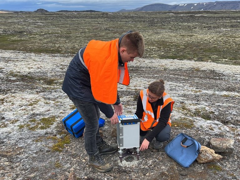
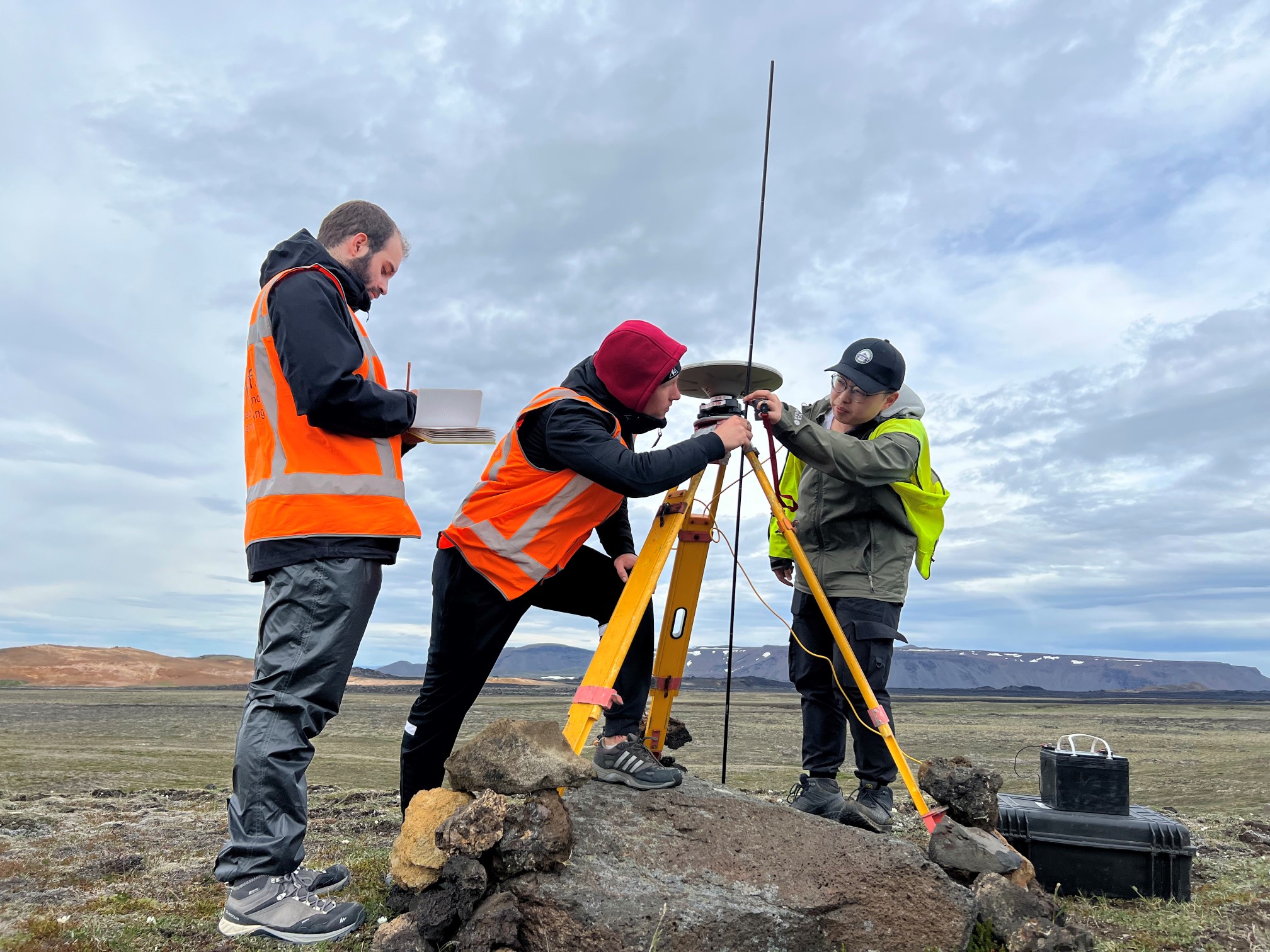
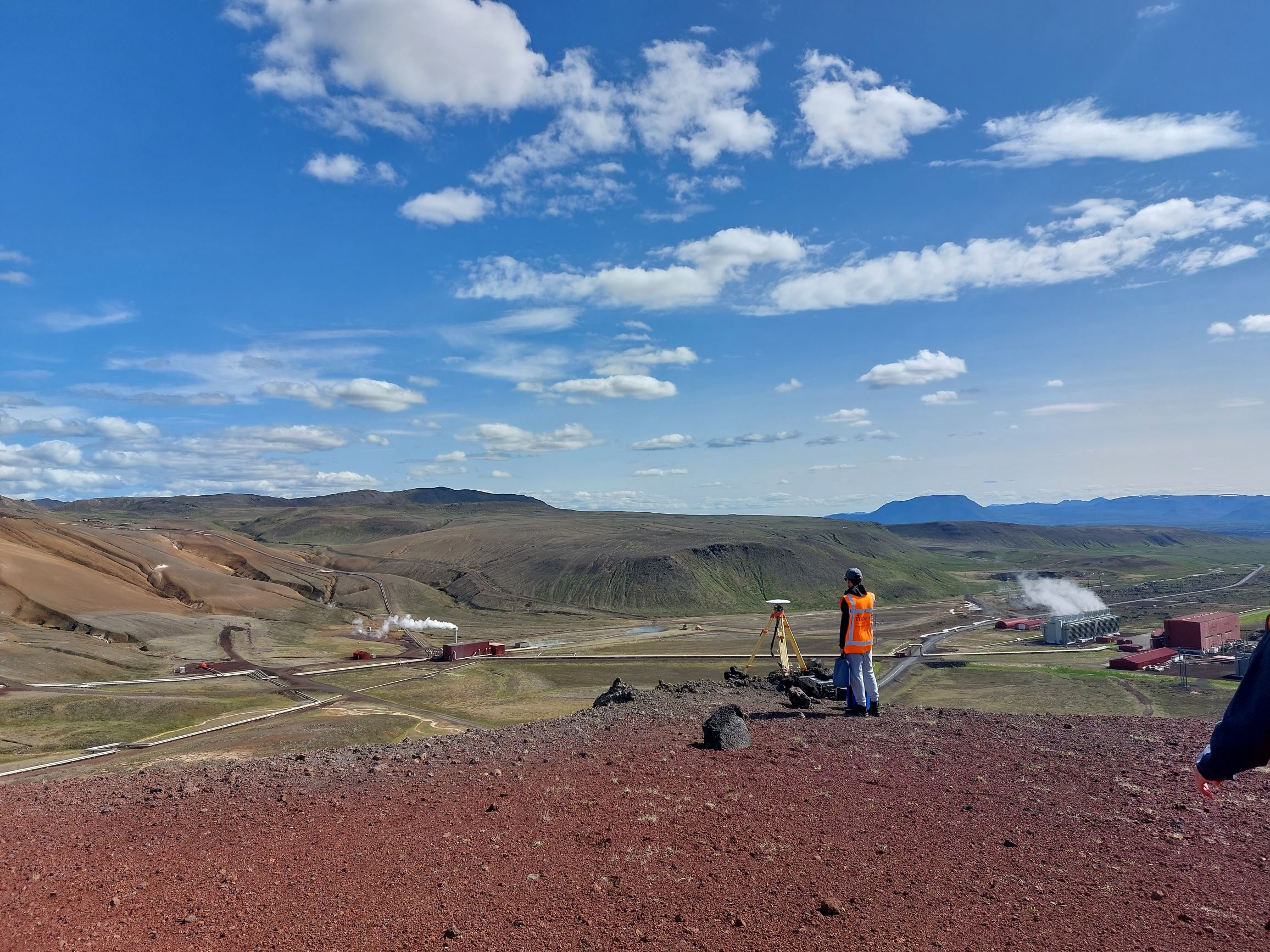
For your field work, you will travel to Iceland and work in teams to define, plan, and design a measurement experiment or field work campaign. Not only do you learn about geological processes, land deformations, and measuring techniques, but you also learn about planning, organizing, and group dynamics.
Students Daniel Blázquez Martín and Julian Biesheuvel both follow the Discipline Earth Observation. We asked them to tell us about their experience in Iceland. Read about their experience here.
The colleagues, the experts that helped us during the process and the topic of research created an environment that, in combination with the Iceland's landscape, made the experience very rich, interesting and motivating.
―
Daniel Blázquez Martín, student Applied Earth Sciences
Lab work
The laboratory work considers the application of state of the art Earth Observation data for extracting essential information on e.g. geohazards and environmental management. Data processing techniques including notably time series analysis are applied on relevant sensor data from GNSS, (In)SAR and optical instruments. Lab contents will be tuned every year towards societal relevant topics.
Graduation Projects
Students who choose the Discipline Earth Observation have a multitude of opportunities for their master’s thesis. Prep for the master thesis starts in Q6 after completing the electives and cross-over section of the general programme. Below are just a few highlighted projects of previous students from the Discipline Earth Observation.
What do graduates of Applied Earth Sciences end up doing in the world? Watch the video’s and read their stories to find out.
Coco Antonissen
An example of a project we worked on last year was funding a company where they developed a service that maps trees in cities and assessed the impact of climate change on those different trees. And with that they helped the municipality to determine where they should grow trees and what kind of trees they should grow there.
Coco Antonissen,
Advisor Satellite Applications, Netherlands Space Office (NSO)
With my team, we aim to support farmers with remote sensing data, which can provide continuous and reliable crop information, enabling the farmers to optimise the available resources and implement timely interventions to maximise yields. As the stress on food supply increases due to the growing world population and climate change, crop monitoring can play a crucial role in ensuring food security.
―
Margot Ridderikhoff, Software Engineer at Planet