
How to map the accessibility of urban green spaces
In a city, green spaces for children are invaluable. This is why it’s a good idea to make passage ways between homes and schools as green as possible. Researcher Roos Teeuwen developed a methodology that assesses existing green zones based on accessibility.
A city is a jumble of buildings, streets, and public spaces. A place where, every day, we are walking or cycling to shops and/or work. And children are no different, having to travel back and forth from home and school. But do children and young adults have enough contact with urban green spaces, such as parks? And how do you map that out?
Link between people and technology
Roos Teeuwen, PhD candidate in Assistant Professor Achilleas Psyllidis' Urban Analytics Lab at the TU Delft Faculty of Industrial Design Engineering, figured it out. With her degree in Architecture and a master's in Geomatics, Roos wanted to build the bridge between engineering and the human perspective at IDE.
"Activities in green areas have a positive effect on our health. Especially when they take place on a regular basis. Therefore, it is important that children and young adults encounter enough greenery in the places they traverse every day, such as on their way to school."
Greenery to walk through
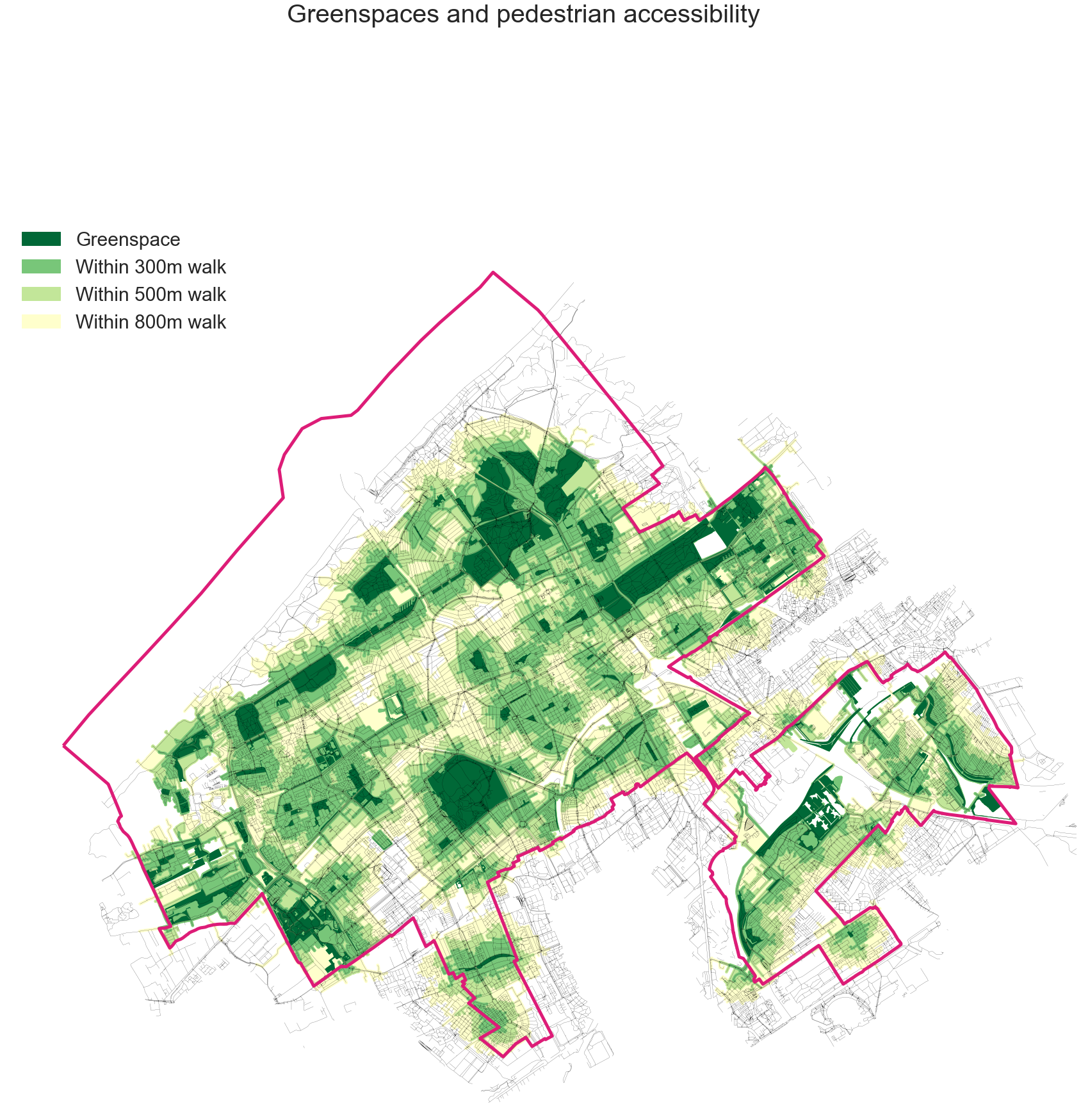
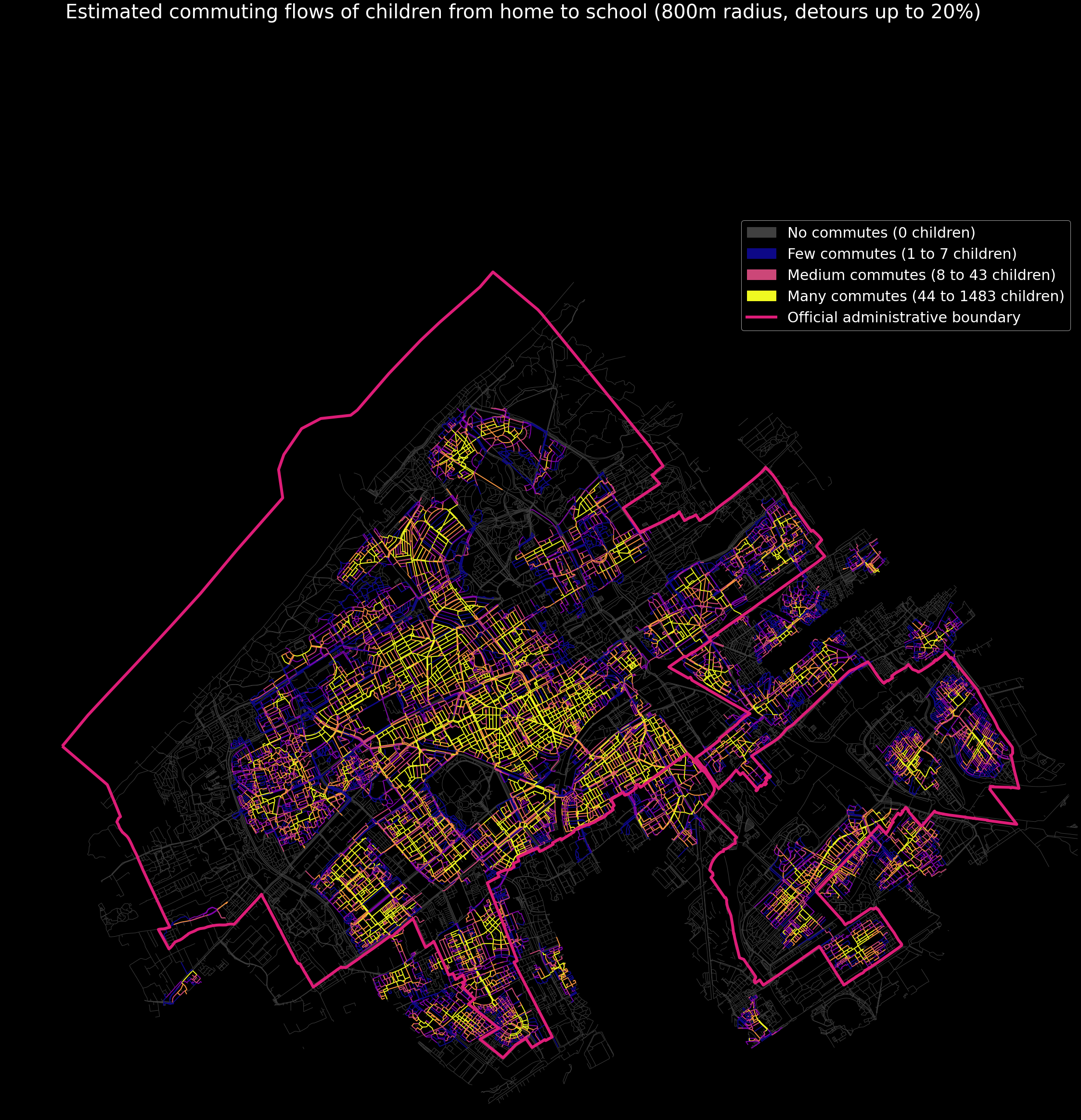
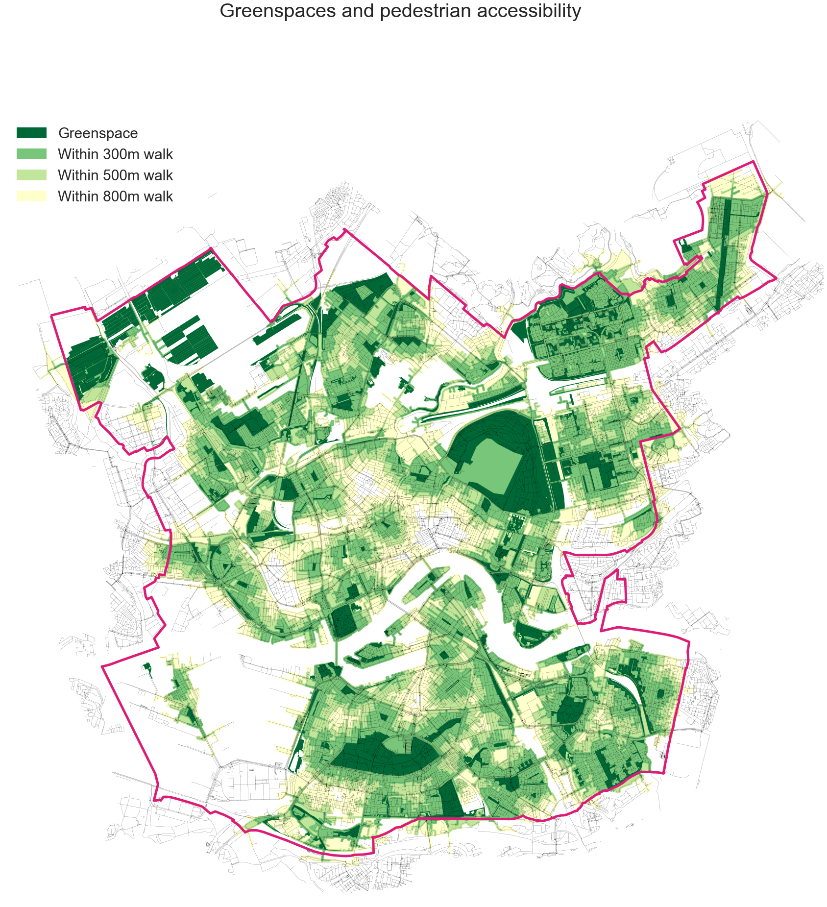
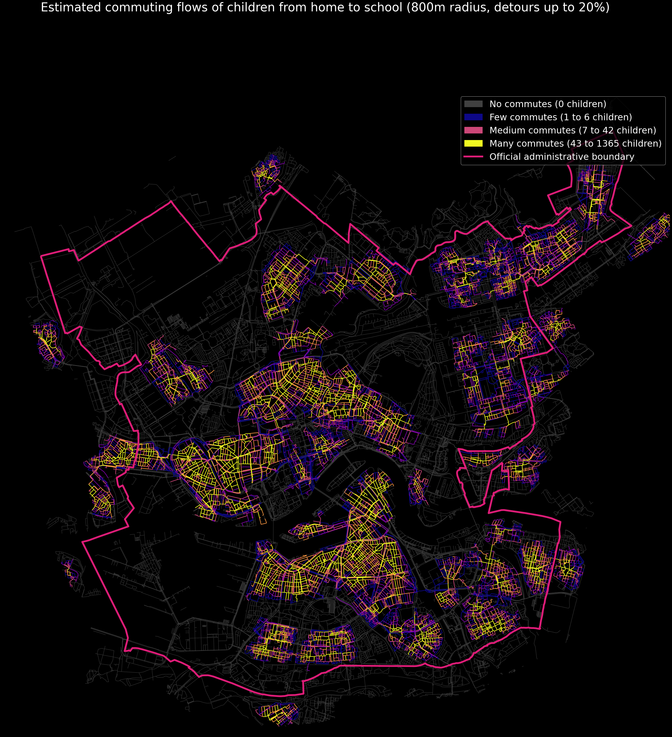
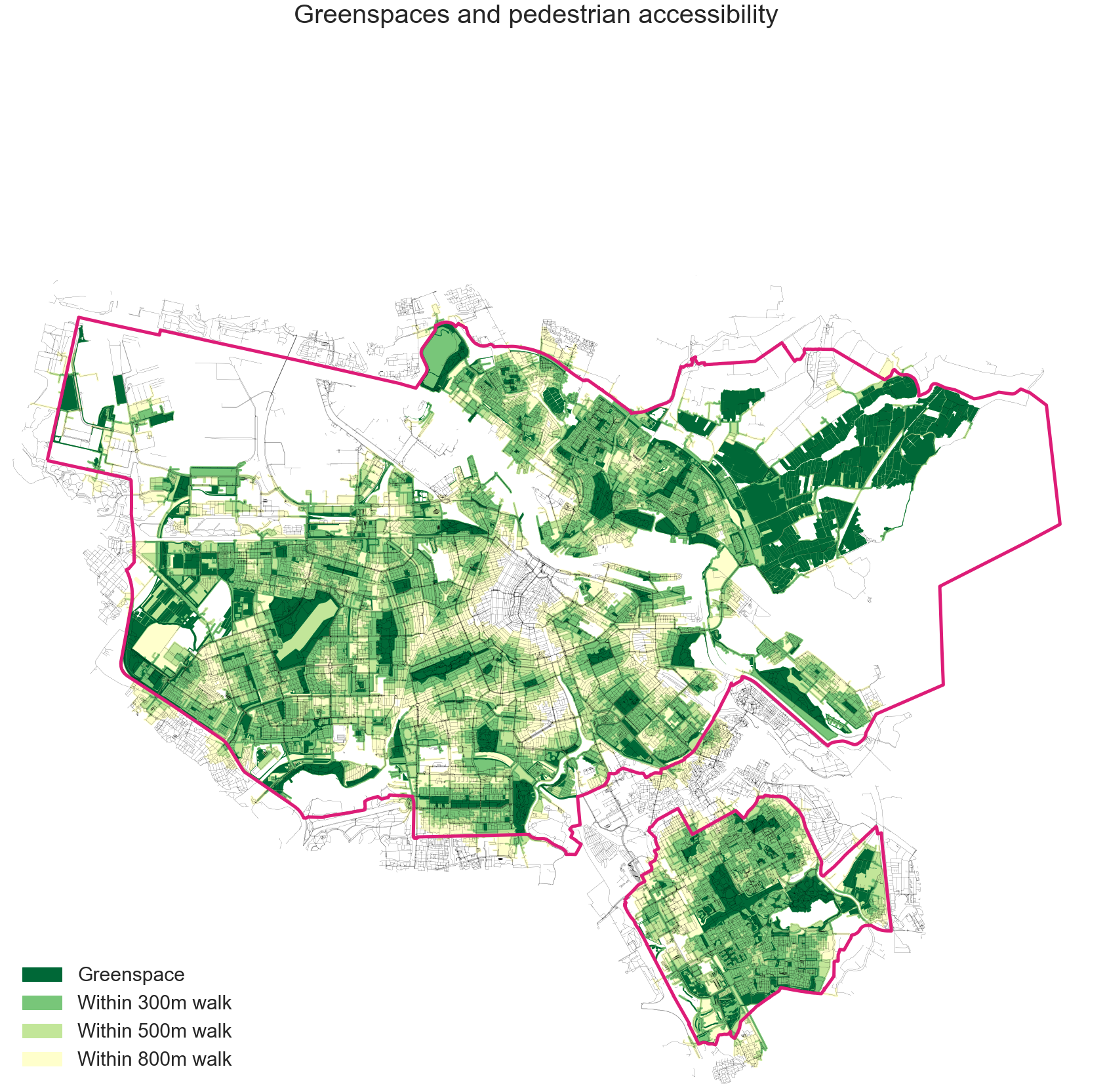
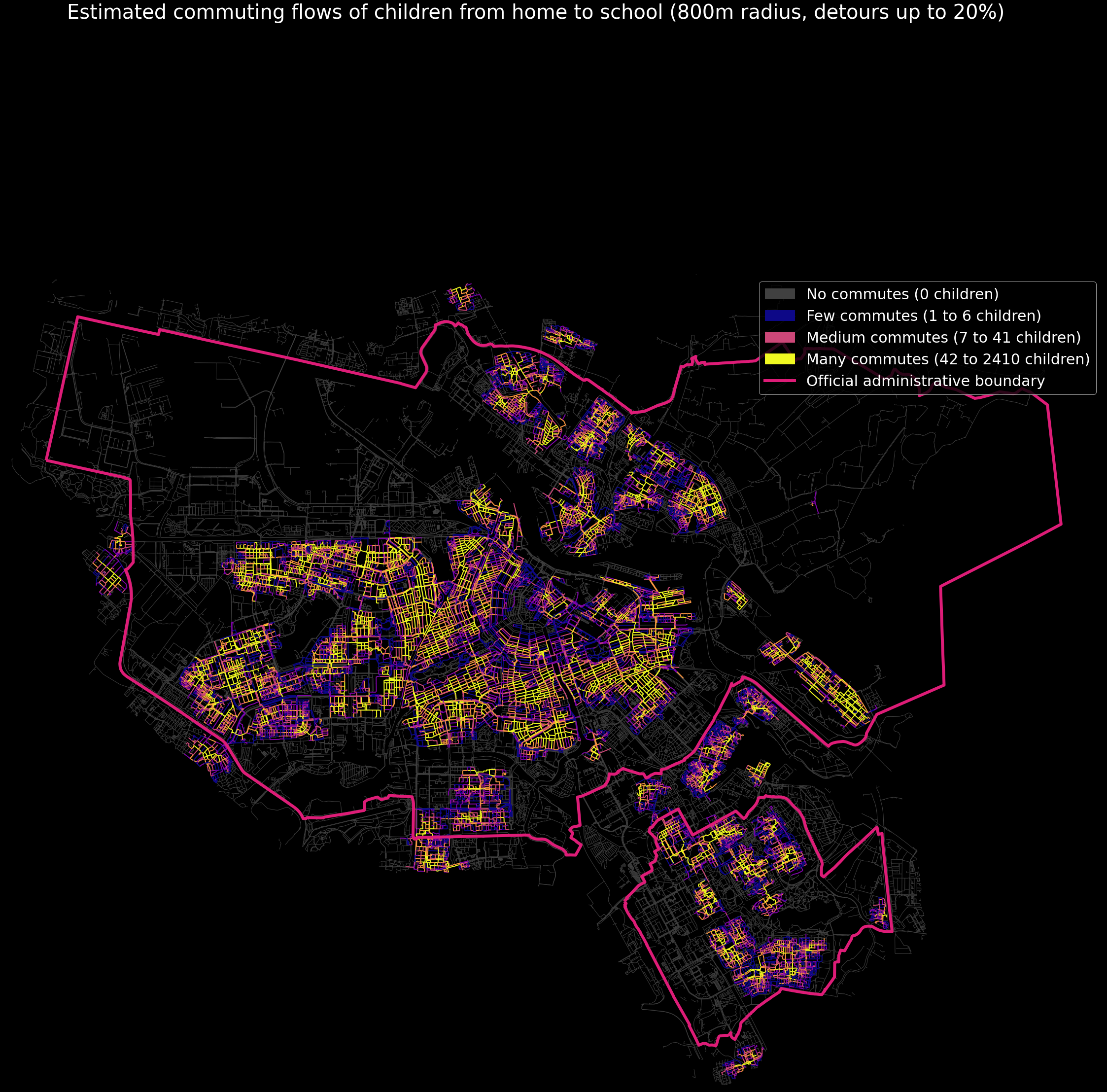
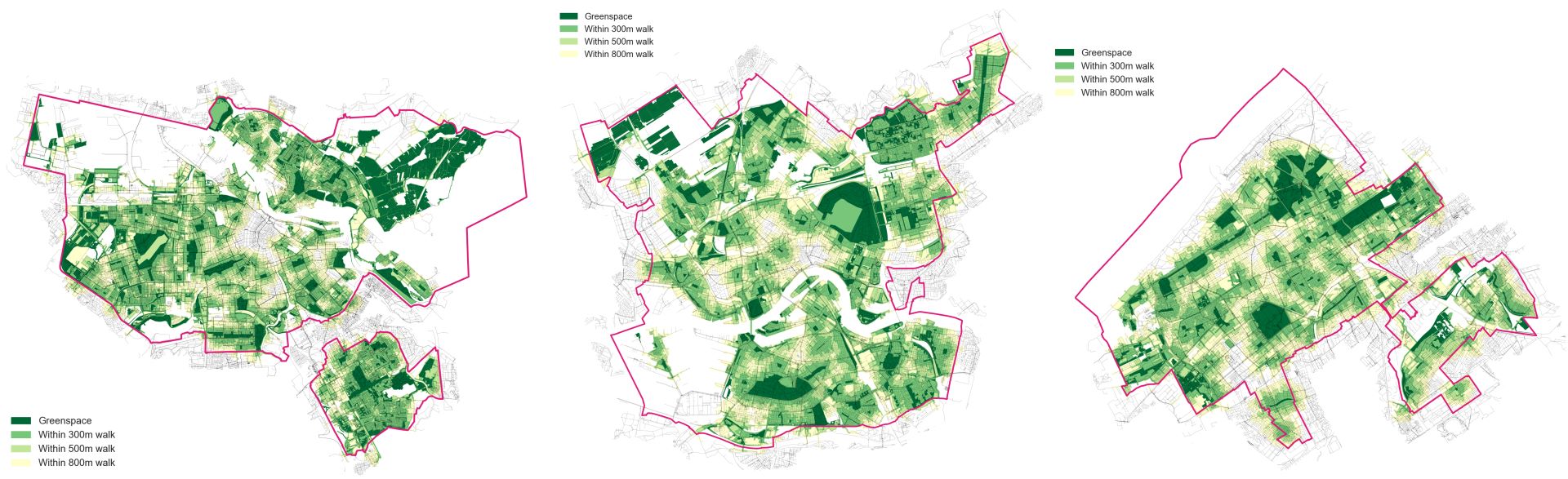
Roos used open data to analyse the movements of children and young adults in the Netherlands' three largest cities: Amsterdam, The Hague, and Rotterdam. She looked at where they could walk within 15 minutes of their homes. What was unique about this research was that she analysed the street networks between people’s homes and schools; what are the possible walking routes between the two?
The result is a heat map that shows the number of children walking along each street. By combining these walking routes with a map of green zones allowed Roos to give each zone a score based on accessibility.
"We noticed that urban green spaces around schools are poorly accessible, if at all, for adolescents. For example, in the centre of Rotterdam. We also saw that especially small-scale green spaces score very well for children on the move, because they are well connected to the surrounding streets and the houses and schools there. The larger green areas, wider than 300 to 450 metres, also score well, but turn out to be too big to just traverse."
Tips for urban planners
"One of our conclusions is that it may be a good idea to identify types of parks, each with its own utility. For instance, it appears that small parks are more likely to be traversed than large ones, which gives them great value. In addition, some green areas seem more suitable for walking through, and others more for playing, or being with friends, for example. Such differences should also be taken into account in urban planning."
"We also noticed that the edge of a park is often a suitable route to walk along. This could be because this is a 'best of both worlds': an efficient route but still in greenery."
Applicable worldwide
This is the first time that an analysis of accessibility to green spaces has been applied on this scale. "The focus of previous studies has often been on accessibility from homes. Studies around traversing green spaces often only study a limited number of people. Now we have a view of entire cities. That's how patterns become visible."
This tool can be used by urban planners worldwide to map the relationships between urban green spaces and (young) people's routes to school. "You can already do an analysis with data from free open source sources such as OpenStreetMap," Roos comments.


And playgrounds?
Not just parks, playgrounds are also important for children living in cities. But when is a playground safe to reach? The answer is more complex than simply a short travel distance. In follow-up research, Roos developed a measurement method that takes into account how easily children can reach a playground without being accompanied by a parent. Together with experts from several European countries, she looked at the influence of traffic, small and large green areas, and suitable places to play outside. This research can also be used by urban planners and policymakers to make healthy and safe choices.


