
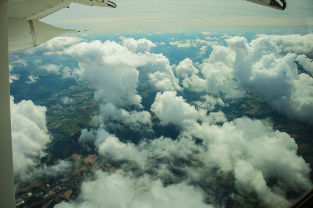
They are a beautiful sight, those cumulus clouds drifting by slowly high above our heads. But what is propelling them? And how do they affect the wind? To find out Louise Nuijens spent a few days with her head in the clouds. Literally.
Louise Nuijens has been through some turbulent times. In early June she cruised through the clouds above Germany for hours on end, not on her way to a holiday destination but to carry out research for the ERC project CloudBrake, a study into how clouds affect wind and vice versa. ‘We often think clouds are propelled by the wind but clouds themselves also influence the wind. Clouds are related to strong upward and downward motions, which transport air from the surface to higher levels in the atmosphere and the other way around. Because winds at high levels can blow differently than near the surface, you can experience for instance an increase in wind speed when convective clouds are overhead Thunderstorm clouds are a good example: very often the wind picks up considerably as they approach.
Few comprehensive wind profile measurements
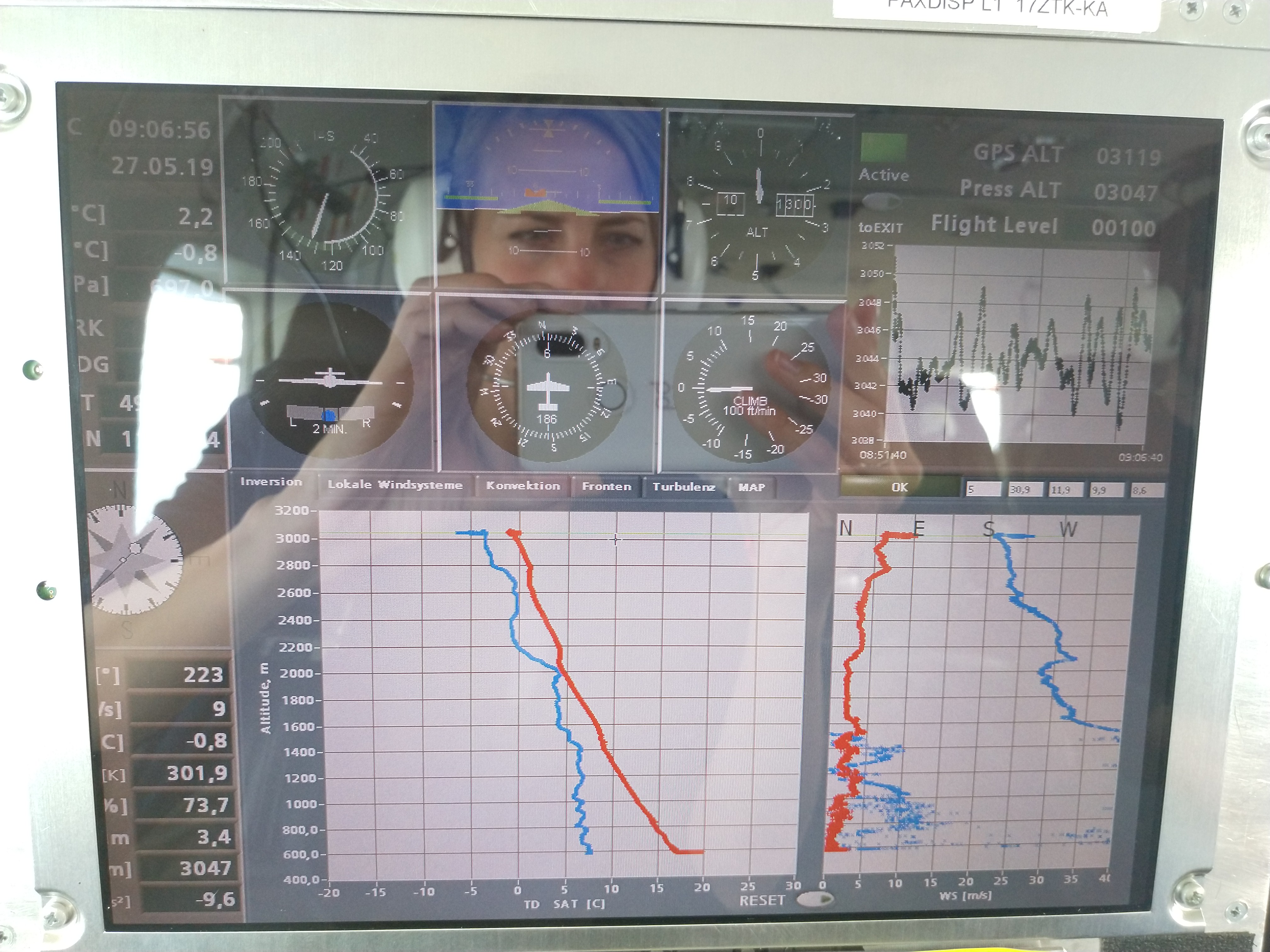
According to Nuijens, current research into clouds is a hot topic, especially the effect of clouds on climate through their interaction with (solar) radiation. However, few studies have looked into the effects of cumulus clouds on wind patterns. ‘Wind measurements are usually carried out close to the earth’s surface. Clouds, however, are higher up in the atmosphere. Wind measurement throughout the full depth of the troposphere and the lower stratosphere are rare, yet they are vitally important when it comes to, for instance, improving the accuracy of weather forecasts.’
CloudBrake
That is why the European Space Agency (ESA) in collaboration with international weather institutes launched a new satellite which measures wind profiles across the planet in a mission called ADM-Aeolus. However, Nuijens explains, the Aeolus satellite does not have sufficient resolution to allow for fundamental research into wind and cloud dynamics. ‘With CloudBrake we could get closer to the clouds and measure the wind profiles in situ. The data we collected will help show how clouds affect wind and provide a proof of concept at the same time.’
Special sensors
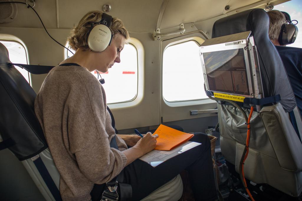
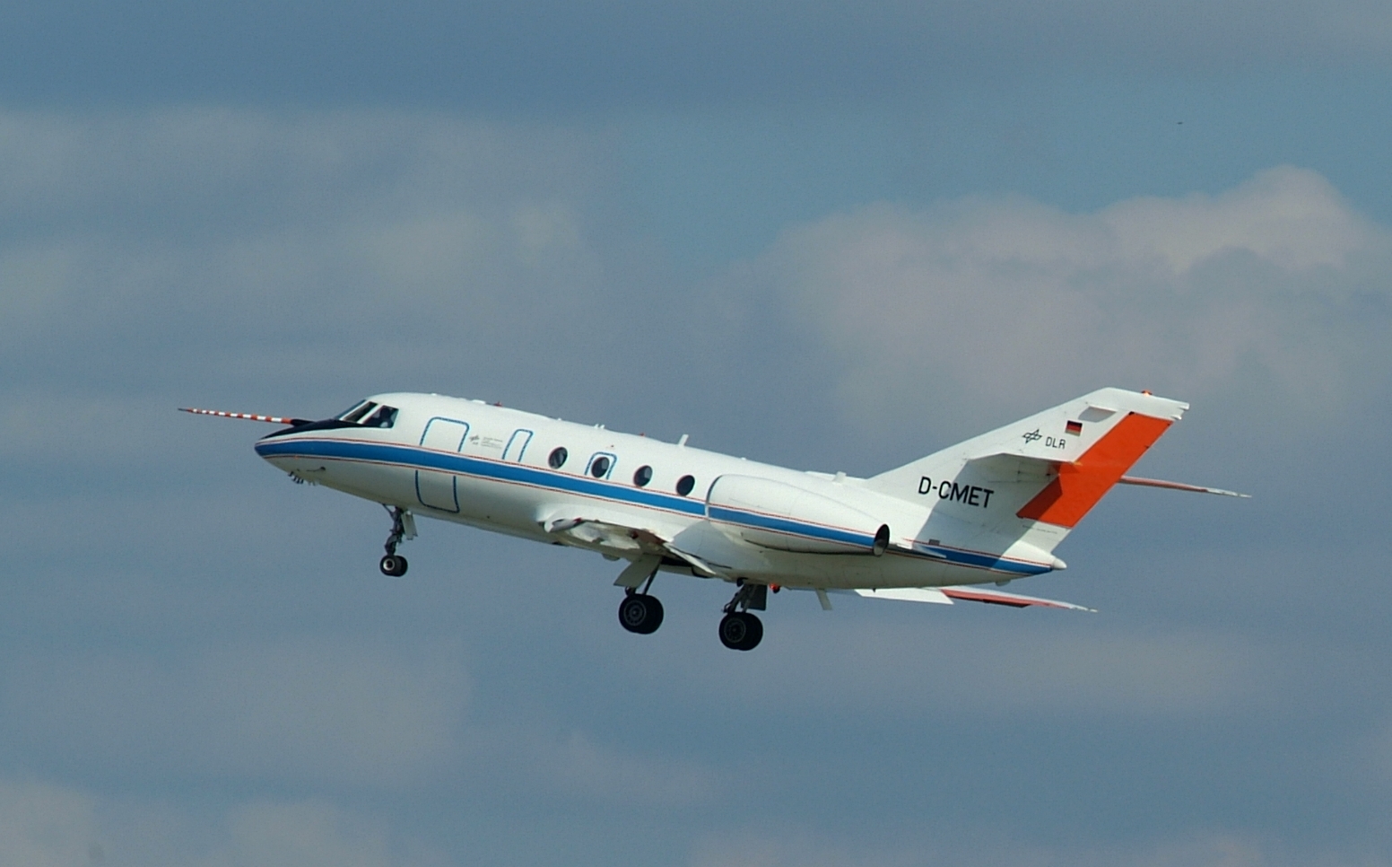
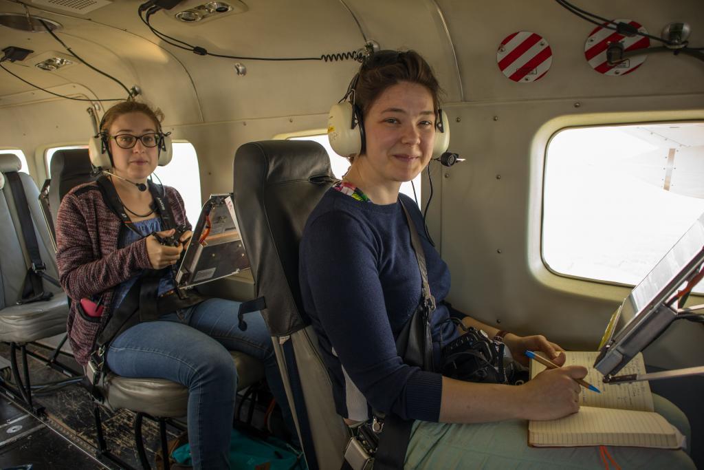
To collect the data Nuijens, accompanied by two PhD students, took to the skies. ‘We chartered two planes from the German Aerospace Center DLR. I was on board of a small propellor plane, the Cessna, flying between or under the clouds to measure turbulence and wind from close by. The other, bigger Falcon plane flew high over the clouds to measure the wind profile going down to the surface. That particular plane was fitted with LIDAR sensors, which emit light that is reflected by photons or molecules to give you wind speed and direction.’

Looking for shallow cumulus clouds
Taking off and flying around the clouds is not as simple as it sounds. The clouds have to be just right, with plenty of shallow clouds, but no thunderstorms or cirrus clouds, which block the view of the LIDAR system. Nuijens: ‘It was difficult to find the right day and location because we were looking specifically for shallow cumulus convection. Shallow cumulus clouds are between 500 metres and two kilometres thick. This type of clouds is hard to predict, as these clouds are small and therefore not resolved by typical weather models. They can also be very sensitive to changes in the weather. All the more reason for us to investigate!’
Permission for take-off
Flight approval presented another hurdle on the way to the clouds. ‘May and June are good months to study shallow cumulus, but it’s the start of the holiday season and the sky is busy with lots of planes,’ Nuijens says. ‘Dutch air traffic management wouldn’t grant us permission, a real shame because the sky over the Netherlands has lots of very nice shallow cumulus clouds. So we could only fly over Germany where cumulus clouds can also quickly develop into deeper thunderstorms. Our flights took off from Oberpfaffenhofen, near Munich. In the end we managed to fly on three of the five days we had planned.’
Bumpy ride
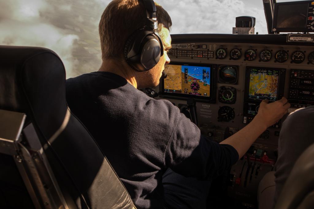
The team spent an average six hours a day flying. 'Not the easiest of field work experiences,' Nuijens says. ‘There’s not much room for manoeuvre, it can be hot or cold and very noisy. There is also a lot of turbulence when you’re in the clouds. I wasn’t affected by it much but one of the students became very queasy. It was important for us to be on board – with expeditions of this kind the researchers have to be present. If there are changes in the weather or clouds, such as very dense clouds or a lack of clouds, you have to be able to improvise and decide, for instance, to move to a different area 100 kilometres away. That of course needs to be authorised. The pilots also have to be extra vigilant when flying through shallow cumulus clouds, because gliders also like to take advantage of the turbulence they generate.’
Optimising wind energy and climate models
Now that Nuijens is back on terra firma she can start processing the data collected during the flights. Although the campaign was primarily geared towards fundamental research – gathering as much knowledge as possible – Nuijens is already looking to the future. ‘A better understanding of wind profiles and the mutual influence of wind and clouds is of great importance for the optimisation of wind energy and weather and climate models.’
Shallow cumulus over oceans
There are many unknowns that have yet to be explored, in particular how these small-scale interactions impact large-scale weather and even climate, Nuijens says. ‘Although the physics behind clouds is principally the same all over the world, how clouds form and how they influence the wind can be different. That is why we want to widen our research to other places, for instance to areas over the subtropical oceans where these clouds are causing major uncertainties in climate projections. That will be a bit more complex. We’d have to do our measurements from a ship. But for now we have plenty of work to process the data from the flights over Germany.’

Related stories


The responsibility gap with self-driving cars

Flying in a V
Related stories
The responsibility gap with self-driving cars