
Ruisdael Observatory maps atmosphere of the Netherlands
What was just a dream five years ago is now starting to become reality. Thanks to hundreds of sensors and several measurement towers, the Ruisdael Observatory continuously provides a clear picture of the atmosphere above the Netherlands. The oldest measurement tower in Cabauw has been in place for 50 years.
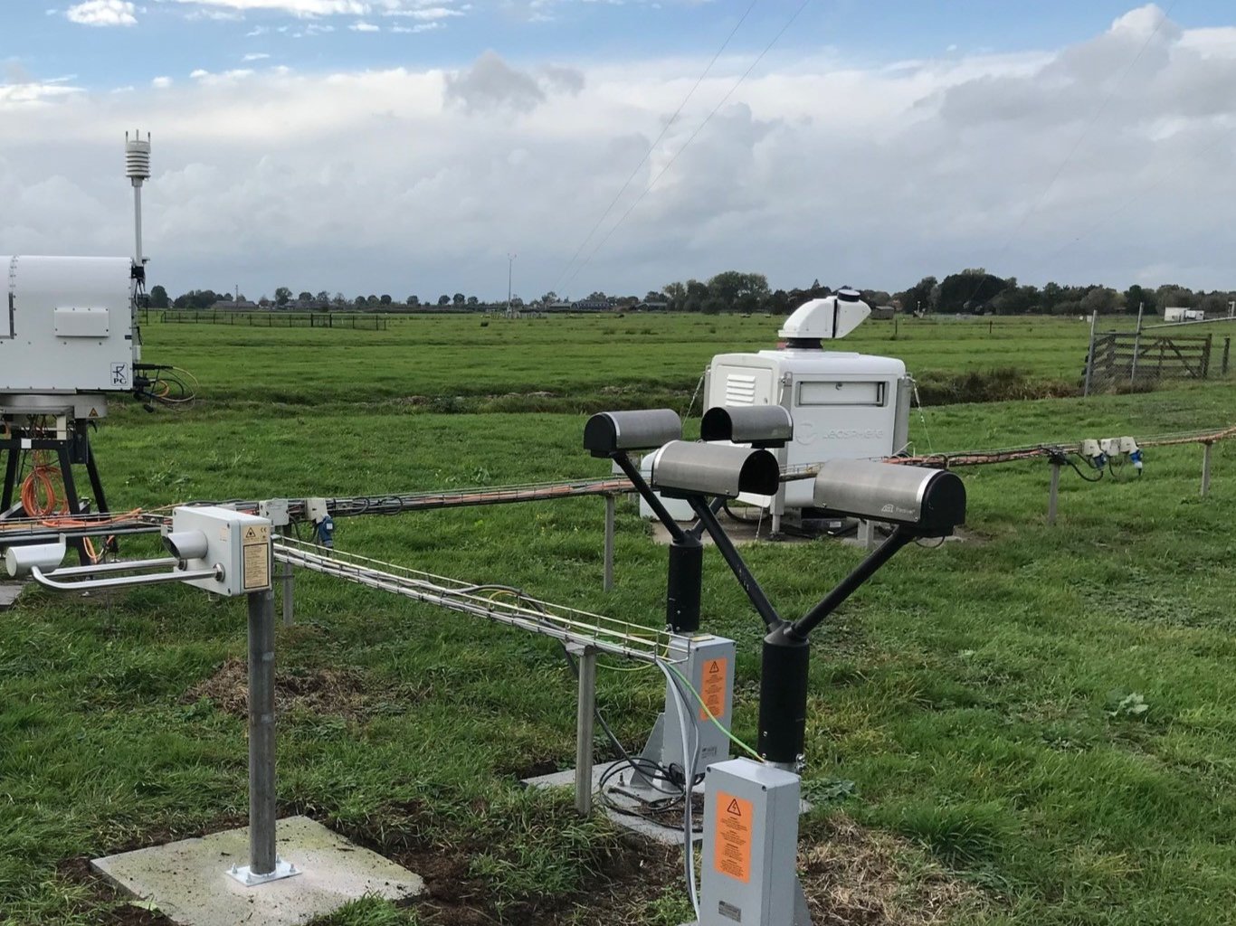
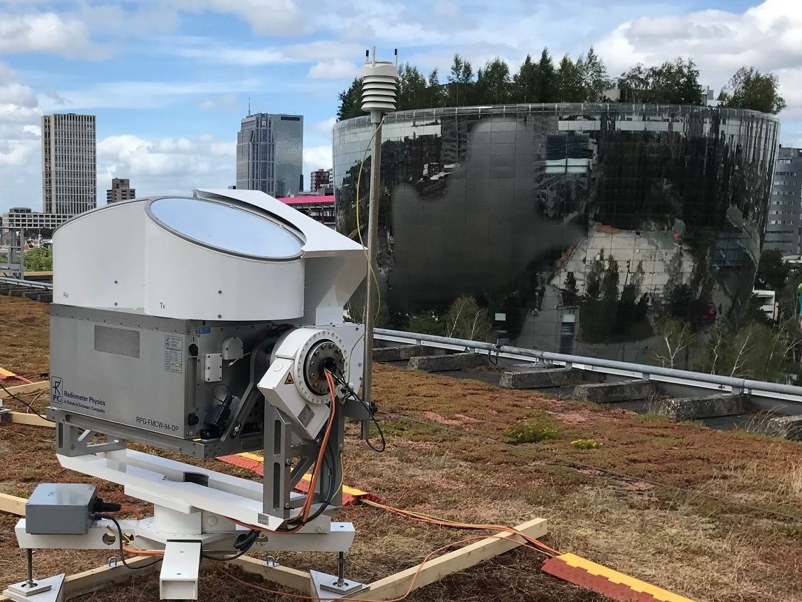
What started with a single mast in Cabauw has now grown into a complete measurement observatory with radars, sensors and other equipment, from Rotterdam to Lutjewad. The Ruisdael consortium was officially launched in 2018. This gave Herman Russchenberg, scientific director of the National Ruisdael Observatory and professor of Atmospheric Remote Sensing at TU Delft, the opportunity to create the long-desired observatory, which is making a simulation of the entire Dutch atmosphere at a resolution of 100 metres.
The Ruisdael consortium brings together a wealth of expertise. Russchenberg: “By working together within this national project, we can achieve a lot more. For example, KNMI is very strong in meteorology and at Wageningen University and Research they have the right knowledge about the influence of the natural environment, such as vegetation. Everyone has their own angle of approach.”
Now, halfway through the decade-long project, the equipment is in place and up-and-running. Models that make simulations of our atmosphere will soon be fed by data and optimised continuously, and people all over the world are watching. “I am particularly happy with the availability of all the data. This really makes it a driver of innovation,” Russchenberg explains. The data is freely accessible to anyone. The KNMI can use the data for their weather model and scientists can use it to enrich climate knowledge. The information is also incredibly valuable to solar and wind energy companies. Their energy parks can be optimised thanks to the new data and additional wind and solar forecasts.
Observatory continues to evolve
Meanwhile, the project continues. “The observatory will never be finished,” says Russchenberg. We are still working hard to incorporate all of the data into a model. But Russchenberg is already looking towards the future. “The focus now is on measurement stations on land. We have measurements from the city, from the forest, from the polder and from the Wadden coast. But the North Sea plays a very important role in our climate. That’s still a blind spot for us at the Ruisdael Observatory. Actually, the future urban climate is also an important issue. Perhaps it would be better to zoom in on that in particular. We are still thinking about it."
Researchers are very positive about the observatory, which provides them with the infrastructure to further expand their atmospheric research:

H.W.J. (Herman) Russchenberg
About the Ruisdael Observatory
The Ruisdael Observatory was created thanks to NWO (The Dutch Research Council) through a National Roadmap for Large-Scale Research Facilities. The permanent facilities are located in the city of Rotterdam, in the Cabauw polder, among the trees in the Loobos forest and on the coast at Lutjewad. This is supplemented by mobile measurement equipment, a drone and an aeroplane. The observatory is a national programme involving TU Delft as well as the Royal Netherlands Meteorological Institute (KNMI), Wageningen University and Research, the University of Groningen, Utrecht University, Vrije Universiteit Amsterdam, the Netherlands Organisation for Applied Scientific Research (TNO) and the National Institute for Public Health and the Environment (RIVM). More information can be found on the website.

Ulrike Dusek- Associate Professor Environmental Sciences at University of Groningen
Ulrike Dusek- Associate Professor Environmental Sciences at University of Groningen
Ruisdael enables us to measure at three levels
Now I am able to do the research I have been wanting to do for a long time. This was not possible without all that data obtained simultaneously from the ground, the air and the clouds. Within the CAINA project, we study how clouds and aerosols or particulate matter influence each other. Aerosols, nitrogen or pollutions can form cloud droplets, thus contributing to cloud formation. Chemical reactions then occur inside the cloud, which change the particles as well as the cloud. To monitor this process, we measure at three levels: On the ground, we measure particles that can later form droplets. We use a helicopter to collect droplets from the clouds, and the measurement towers enable us to capture particles falling from the clouds at an elevation of 200 metres. By doing so, we hope to find out what happens to those particles in the clouds. I want to gain a thorough understanding of this process. Because aerosol particles or pollution particles are a starting point for cloud formation and allow clouds to reflect more sunlight. This has a cooling effect on the climate. But the particles involved in the chemical reaction in the clouds can also be converted into unhealthy and harmful substances.

Marc Schleiss- Assistant Professor Geoscience and Remote Sensing at TU Delft
Marc Schleiss- Assistant Professor Geoscience and Remote Sensing at TU Delft
Raindrops are the fingerprints of clouds
Predicting precipitation is an incredibly complex process. You would have to install thousands of rain sensors to get accurate measurements. The only way to efficiently monitor this on a large scale is by remote sensing, which involves a great deal of uncertainty. Precipitation data now comes in 24/7 through the Ruisdael Observatory. Raindrops are like the fingerprints of the clouds. Continuous precise measurements on the ground make it possible to interpret remote sensing signals much better. We measure the number and size of the raindrops, and speed at which they fall down. At the same time, the observatory scans the clouds above the rain. This is the golden combination. My goal is to properly process all of this data and make it available to everyone. We are especially interested in the dynamics of drop size distribution during most intense storms: does this depend on temperature, or wind? And how will it change in a warmer climate?

Louise Nuijens- Associate Professor Atmospheric Science at TU Delft
Louise Nuijens- Associate Professor Atmospheric Science at TU Delft
Ruisdael helps us understand the climatology of wind and clouds
Many clouds above the Netherlands occur by convection, hot air flows up and back down again. I study how the wind blows differently in the presence of cloud fields. For example, wind is slowed down by friction close to the earth’s surface, while cumulus clouds (sheep clouds) can actually cause the wind to accelerate. Within the CMTRACE project, we use wind lidar to measure how the air moves beneath the clouds. Such measurements are not unique, but thanks to the Ruisdael Observatory, it is now possible to measure long time series of horizontal, upward and downward wind in high resolution. Long time series helps us understand the climatology and to derive statistically relevant correlations. With this we can, for example, validate and optimise KNMI’s Harmonie weather model. This weather model includes many parameterisations: assumptions about cloud fields and convective air currents.