Data Assimilation
The objective in data assimilation is generally to find the state of some system. A hydrologist might want to find the streamflow in the River Maas at Maasluis or volumetric soil moisture in the Volta basin. A meteorologist might want to know the current state (temperature, pressure, velocity field) of the atmosphere. An oceanographer might want to know the current state (velocity, depth, temperature) of the Atlantic Ocean.
To find the state we could just use a model, but the modeled estimate is subject to structural errors from simplifications, assumptions and weak assumptions. It is also affected by model input uncertainties e.g. imperfect forcing data and uncertain model parameters.
We could also just observe the state using either ground-based observations or remote-sensing. Ground-based observations are generally point-observations and they may not represent highly variable fields such as precipitation. They may also suffer from uneven spatial distribution and inadequate spatial sampling. Remote-sensing offers many advantages. Satellite data can offer global coverage. However, remote-sensing is also not ideal. The observations may be indirect, i.e. the quantity of interest might not be directly measured, so a model might be required to convert it to the state of interest. For example, in microwave remote-sensing, a backscatter or brightness temperature is measured and a model is required to relate this to soil moisture. Coverage may be global, but what about vertical distribution? e.g. the satellite may measure soil moisture in the top few centimeters, while we might want to know about root zone soil moisture.
Data assimilation is a way to combine models and observations in an optimal way to obtain an estimate of the state that is better than that from models or observations alone. The optimal estimate should be closer to the truth than either the observations or the model. The error in the new estimate should be less than the minimum of the error from the model and the error from the observations.
There are essentially three types of problems: interpolation, filtering and smoothing. For each type of problem, there are many algorithms to choose from. Optimal interpolation and kriging are popular interpolation algorithms. The classic, extended and ensemble Kalman filter are popular filtering approaches. 4DVAR, the ensemble Kalman smoother and the Rauch-Tung-Striebel smoother are well known batch estimation or smoothing algorithms. At Water Resources Management, we generally employ ensemble techniques in our research because they are easy to implement, allow us to plug-and-play with different models and are flexible in terms of how uncertainty is accounted for.
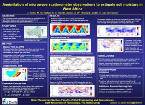
Case Study in West Africa:

file:///H:/My%20Documents/Studass/Website%20WRM/SusanSteeleDunne[1]/Tools/EnKFWestAfricaPoster.pdf
Examples of data assimilation projects at WRM are:
- Assimilating GRACE terrestrial water storage data into a conceptual hydrology model for the River Rhine.
- Vegetation: A novel soil moisture sensor?
If you are interested in working on a data assimilation project at Water Resources Management, please contact Susan Steele-Dunne