Integrate and store 3D roads and terrain for navigation purposes
Dimitrios Mouzakidis, Puti Puti Nabila Riyadi, Konstantinos Nestoras, Leon Xu, Na Liu, Stein Köbben
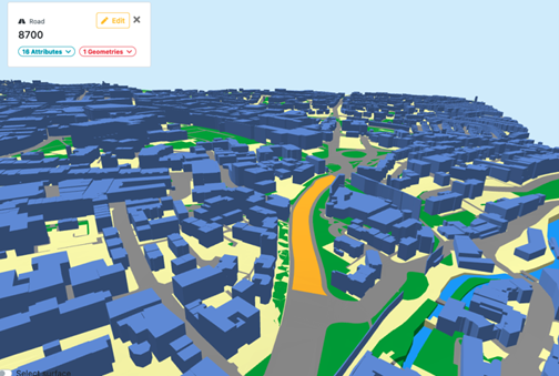
Incorporating 3D roads and terrain is essential for enhancing the user experience in navigation. Our project objective is to extract 3D road data and seamlessly integrate terrain information from various data sources to improve navigation experience. The starting point of the project is a dataset of road centerlines with attributes such as width and number of lanes. The main step aims at creating 2D polygons with elevations utilizing external elevation data to associate elevations with road segments. The most challenging part of the project lies in road overpasses and intersections where topology in 3D space must be handled correctly. We believe that creating high-quality 3D road data will significantly enhance the coherence and intuitiveness of the user experience during mobile navigation.
More information
- Synthesis project: "Integrate and store 3D roads and terrain for navigation purposes"