Hydrological and hydrochemical systems analysis of coastal aquifers
Coastal aquifers are highly complex systems due to: (a) small scale variations in lithology, vegetation, sea-spray deposition, surface-groundwater interactions and water density; (b) added dynamism because of fluctuations in sea level, coastline position and river discharge; and (c) multiple anthropogenic impacts. Due to their location in often densely populated areas, coastal aquifers tend to be particularly data-rich. Their groundwater typically shows a broad spectrum in terms of origin, salinity, alkalinity, redox potential, extent of ion exchange and degree of pollution. Managed aquifer recharge is often applied to reduce salinization risks and to store surface water for later use. Coastal aquifers are also extremely vulnerable to effects of climate change, especially in delta's and estuaries, due to a combination of sea level rise, land subsidence, increased use of the subsurface in urban areas, and expected higher frequencies of river flood and drought occurrences. Thus, a systems approach is needed to order the various types of information, to prepare maps showing past and current distributions of the hydrological and hydrochemical systems, and to show how water quality evolves along flow lines within the aquifer system.
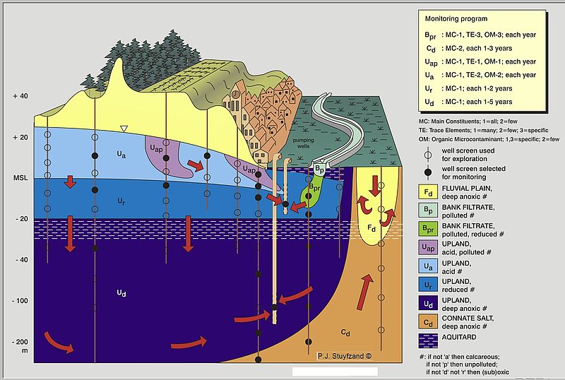
The research aims at the development of tools to: (i) manage and evaluate large hydrochemical data-sets; (ii) map hydrochemical systems and trends in spatial patterns; (iii) establish natural background values of groundwater composition and pollution levels; (iv) derive hydrological system parameters through analytical approaches; and (v) derive hydrological characteristics from hydrochemical data. Some of these tools are already worldwide applied, and an extension of the tool box is to be based on current research on various coastal aquifers in among others the Netherlands, the Eastern Po plain (Italy), Abu Dhabi, S Korea, and Lebanon.
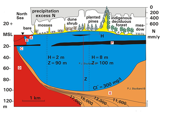
Another part of this research theme is devoted to the understanding of the chemical transformation of rain water (atmospheric deposition) into shallow groundwater under various conditions (different vegetation, different distances to the coast and calcareous versus decalcified terrains).