PhD Research
The Urbanism Research Programme provides a lively stimulating environment for PhD research. Candidates also participate in the TU Delft Graduate School which provides doctoral education in research skills and personal and career development.
PhD work forms a major part of Urbanism research. The research programme is organised in research themes, and all proposals must demonstrate how they will contribute to the themes. The overall Urbanism Research Programme can be viewed here. PhD candidates participate in a four-year programme. In the first year, the candidate prepares a comprehensive research proposal and a long paper, which is assessed by a professorial panel following a public presentation.
PhD opportunities may arise for specific projects funded by the Dutch National Research Organisation (NWO) or other funding bodies. In these cases the PhD candidate will be employed by the TU Delft to undertake a specific project. These opportunities will be advertised at ‘Working at TU Delft’. However, most PhD candidates find their own funding. In this case TU Delft offers supervision and an academic environment and the candidate performs research in the university on a daily basis based on hospitality to enable him/her to write a thesis within four years. The PhD candidate may be granted time or financing by a) a foreign university; b) personal grant-issuing organisations such as national research councils, or c) his/her employer.
If the Urbanism Programme decides to accept an applicant on a preliminary basis who has not already secured funding, supervisors are able to assist with the preparation of applications for grant funding, but the responsibility for finding funding rests with the applicant. Applicants will need to explain on their application where they expect to gain funding. We do not accept applicants who are self-financed from personal funds.
Call for applications
New topics will be posted periodically on this website.
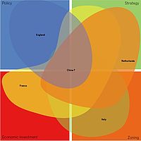
Topic 1: Cross-national comparison of territorial governance, spatial planning and regional design.

The Urbanism Research Programme conducts research on the theme of international comparative planning and regional design. We aim to take forward comparative research that builds knowledge of the key factors that determine the performance of
regional and urban planning and design, and which supports more responsive and progressive planning that can influence spatial development in more sustainable directions. We are keen to develop our comparative knowledge of spatial planning in China in collaboration with colleagues at South China University of Technology through the joint Centre on Urban Systems and Environment. The theme will continue to build on previous work, for example:
Nadin, V. and Stead, D. (2008) European spatial planning systems, social models and learning, DISP 172, January, 35-47;
Nadin, V. (2013), and International comparative planning methodology: introduction to the theme, Planning Practice and Research, 27(1): 1-5.
Potential supervisors include Vincent Nadin, Dominic Stead, Wil Zonneveld and Marcin Dabrowski.
Topic 2: The meaning and role of ‘spatial planning’ and ‘territorial governance’ under difficult and adverse conditions
Many recent spatial planning reforms across the world have led to shifts in planning regimes: often from statutory plan-led to development-led approaches. In various countries regional design and the ‘art’ of making spatial representations and the imagination of spatial metaphors has emerged as a powerful tool in capacity- and consensus building in multi-actor settings. It is often used as a
way of overcoming conflicting rationales and images of desired spatial development and spatial futures. In practice, regional design fulfils different roles in different situations, depending on the actor settings and the nature of the issues at hand. We would like to develop research that focus on the performance of regional design in various institutional settings in different countries and (urban) regions. This research will continue current research including:
Balz, V. & Zonneveld, W. (2014) Regional Design in the Context of Fragmented Territorial Governance: South Wing Studio, European Planning Studies, OnlineFirst doi 10.1080/09654313.2014.889662.
Potential supervisors include: Wil Zonneveld, Vincent Nadin, Dominic Stead
Topic 3: The performance of regional design in complex governance settings.
Many recent spatial planning reforms across the world have led to shifts in planning regimes: often from statutory plan-led to development-led approaches. In various countries regional design and the ‘art’ of making spatial representations and the imagination of spatial metaphors has emerged as a powerful tool in capacity- and consensus
building in multi-actor settings. It is often used as a way of overcoming conflicting rationales and images of desired spatial development and spatial futures. In practice, regional design fulfils different roles in different situations, depending on the actor settings and the nature of the issues at hand. We would like to develop research that focus on the performance of regional design in various institutional settings in different countries and (urban) regions. This research will continue current research including:
Balz, V. & Zonneveld, W. (2014) Regional Design in the Context of Fragmented Territorial Governance: South Wing Studio, European Planning Studies, OnlineFirst doi 10.1080/09654313.2014.889662.
Potential supervisors include: Wil Zonneveld, Vincent Nadin, Dominic Stead
Topic 4: The process of metropolisation in polycentric metropolitan regions.
Metropolisation is understood as the process through which a loose collection of proximally located cities starts to become more functionally, culturally and institutionally integrated. It can be assumed that in theory metropolisation enhances
performance, and indeed this conviction underlies many European metropolitan development strategies. Yet little is known about how this potential is realised in practice, nor has the relationship between the level of metropolisation and performance of polycentric metropolitan areas been explored. Issues that can be addressed include the development of regional identity alongside urban identities, overcoming governmental fragmentation in polycentric metropolitan regions and the development of functional relationships within such regions. Also, from an economics perspective, the concepts of ‘borrowed size’ and ‘agglomeration shadows’ within polycentric metropolitan regions deserve further exploration. This research builds for instance on:
Meijers, E., Hoogerbrugge, M & K. Hollander (2014) Twin Cities in the Process of Metropolisation, Urban Research & Practice, 7(1), 35-55
Burger, M., Meijers, E., Hoogerbrugge, M & J. Masip Tresserra (2014) Borrowed Size, Agglomeration Shadows and Cultural Amenities in North-West Europe – European Planning Studies; available online first DOI: dx.doi.org/10.1080/09654313.2014.905002.
Potential supervisors include: Evert Meijers, Wil Zonneveld.
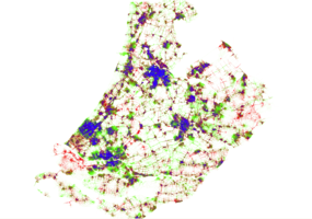
Topic 5: The relationship between the spatial and socio-economic performances of built environments.
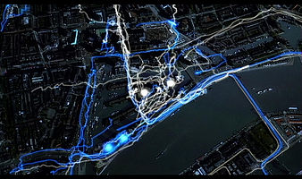
Urbanism is concerned with the relationship between the spatial structure of the physical built environment and social and economic life. However, there is a great uncertainty about the effect of the
physical world on society and how it varies according to the local cultures and planning laws or regulations. This hinders effective intervention though planning and urban design.
Our research aims to improve understandings of the variable performance of the physical arrangement of the built environment, the spatial structure of the transport networks at varying scales from neighbourhood to regional levels, in terms of economic vitality, social cohesion and environmental sustainability (Van Nes, Akkelies, 2011, “Measuring spatial visibility, adjacency, permeability and degrees of street life in urban areas. The one- and two-dimensional isovists analyses in Space Syntax”, in: S. Nijhuis, R. van Lammeren, F. van der Hoeven (eds) ”Exploring the visual landscape; Advances in Landscape physiognomic Research in the Netherlands”, IOS press, Amsterdam, Ye, Yu, and Van Nes, Akkelies 2014, “Quantitative tools in urban morphology: Combining space syntax, spacematrix and mixed-use index in a GIS framework” in: Journal of Urban Morphology (forthcoming); Van Nes, Akkelies and Lopez, Manuel, 2010, “Macro and micro scale spatial variables and the distribution of residential burglaries and theft from cars: an investigation of space and crime in the Dutch cities of Alkmaar and Gouda”, in: Journal of Space Syntax, no 2.). We examine the extent to which planning and other urban interventions take account of knowledge of these relationships and with what effects.
Future research will explore the relationship between physical layout, building functions and social life, comparing historic districts with contemporary developments in different cultural (national) contexts. We are particularly interested in the effects of the spatial morphology of built environments on society in terms of the incidence of crime, vitality of shopping areas, livability of housing areas and land values. This requires developing or improving existing analyses tools, to test combination of existing tools, and to deal with the possibilities of improved computer capacities and software development useful for handling research on built environments. Other methods for analyzing the spatial properties of built environments needs improvement, from a phenomenological as well as from a morphological and topological/configurationally approach.
Potential supervisors include Akkelies van Nes.
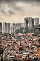
Topic 6: Planning and Designing for Development: Spatial Strategies for Urban Development in Rapidly Growing Economies.
The Urbanism programme undertakes critical analyses of urbanization processes in the developing world, including the comparative study of planning frameworks, tools and cultures, governance structures and the dynamics of spatial form, as well as issues arising from the interactions between planned and unplanned, formal and informal and legal and extra-legal urban development. We examine the interactions between spatial planning, political structures, social struggles and the built environment. This research cluster relies on expertise of several staff members and builds on previous research and education programs carried out in the Department of Urbanism of TU Delft. Prospective PhD candidates must be able to conduct research aimed to inform the preparation of plans and strategies that tackle issues associated with international urban development. Research in this area must also underpin education offered at Master level in the Department of Urbanism. Our recent work includes:
Ballegoijen, J. V. & Rocco, R. 2013. The ideologies of informality: Informal urbanization in the architectural and planning discourses. Third World Quarterly, 34, 1794-1810;
Fernández-Maldonado, A.M. (2014) Incremental housing in Peru and the role of the social housing sector, in: van Lindert, P., Smets, P. & Bredenoord, J. (eds) Affordable Housing in the Urban Global South, London and New York: Earthscan;
Fernández-Maldonado, A. M. (2011) Trends toward Urbanization in the Americas, in: H. M. Tarver (ed.), World History Encyclopedia, Era 8: Crisis and Achievement, 1900-1945, Santa Barbara, CA: ABC-CLIO;
Pojani, D. 2013. “From Squatter Settlement to Suburb: The Transformation of Bathore, Albania.” Housing Studies 28 (6): 805-821.
Potential supervisors include: Ana María Fernández Maldonado, Roberto Rocco.
Topic 7: Doing a PhD at the research group 3D GeoInformation
The 3D Geoinformation research theme studies the technologies underpinning geographical information systems (GIS), and aims at designing, developing, and implementing better systems to model 3D cities, buildings and landscapes. The research focuses on spatial data, and specifically the modelling, structuring, maintenance, analysis and dissemination of large amounts of (3D) geoinformation about urban areas.
3D geoinformation can make a key contribution to the design and planning of interventions in the urban environment. Thus, serving the needs of practice is extremely important and we develop solutions in close collaboration with users such as experts in noise, wind and emergency evacuation simulations. We have a history of successful collaborations with the industry and the government: our research has led to open source software, standards, and patents for the management of 3D geographic information.
Example research questions
- 3D geoinformation infrastructure: how to collect, model, maintain or disseminate 3D information about urban and rural areas and use it for many different applications?
- How to reconstruct semantically rich 3D city models?
- What data structures and algorithms are needed for 3D modelling?
- How to deal with different levels of detail of 3D geoinformation?
- How to connect information from the design&construction world (BIM) with geo-information applications?
Interested in doing PhD in our group?
If you are interested doing a PhD in our group there are two possibilities:
(1) Apply for a paid position
Sometimes paid positions become available for a postdoc or PhD candidate, when a research project has been granted funding. Whenever we have such a position, you can find it at our home page: https://3d.bk.tudelft.nl
(2) Open application with own funding
If you have found own financial support, you can apply for a PhD position in our group to either work on your project full-time as a contract PhD candidate or keep your current job and/or stay where you live and work on your project part-time as an external PhD candidate. Please contact the chair of the group for more information and the conditions for such a type of PhD research: Prof dr Jantien Stoter, j.e.stoter@tudelft.nl
Process of consideration of applications
- Applications must be made through the Graduate School AB+E. See the application & selection process on the Graduate School website .
- Please state clearly at the top of your proposal which topic your proposal addresses.
- A panel will assess the applications and create a shortlist. The criteria are:
a) the scientific quality of the research proposal;
b) the societal relevance of the research proposal;
c) the quality of the curriculum vitae including academic qualifications;
d) other considerations like evidence of writing skills, funding and English language competence. - The panel will pay particular attention to the ability of the candidate to develop knowledge in the relevant topic.
- Shortlisted applicants may be interviewed, if necessary by video link or telephone.
- Subject to funding, the successful applicants will be given hospitality for 4 years, during which they will undertake a formal progress review (a go,no-go). Following a successful review the candidate will register with the University for the PhD.