Archive
09 December 2019
Waddenacademieprijs Vincent Vuik
Vincent Vuik has been awarded the price of the Wadden Academy for his PhD thesis Building Safety with Nature. Salt Marshes for Flood Risk Reduction.
09 December 2019
Student project opportunity
Fact-finding study for flooding of Venice (Nov 2019) and performance of the MOSE barrier.
08 December 2019
Continuously scanning the coast
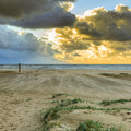
Hotel Atlantic in Kijkduin overlooks the North Sea. On its deserted roof a state of the art laser scanner is monitoring the beach every hour, 24/7. Sander Vos hopes the resulting data will provide insight into the restoration of the coast after a storm when part of the beach and fore dunes disappear into the sea. With the information provided by the scanner he and his TU Delft colleagues hope to become ‘coastal weathermen’ who will be able to predict exactly how the beach behaves after a storm.
04 December 2019
Marker Wadden: Building wetlands with soft mud
Markermeer, a manmade lake in the North of Holland, functions as a freshwater reservoir and a buffer against floodwaters and droughts. Its 680 sq kilometres have a predominantly soft mud layer at the lake’s bed. Due to its shallow depth of 3 to 5 meters, the wind-induced waves are strong enough already at low wind speeds, to move the soft mud through the water. The dam, connecting Lelystad and Enkhuizen, add to the trapped sediment causing turbidity. The severe turbidity hampers light penetration through water and the overall ecological development. Natuurmonumenten and its consortium partners (Boskalis, Van Oord, Royal Haskoningh DHV, Deltares and Alterra) are committed to bringing life back to this lake. By removing the mud layer from the lake’s bed and re-using the soft sediment to build wetlands, they are expecting to transform a part of the lake into the new nature reserve ‘Marker Wadden’.
03 December 2019
Understanding and predicting sandy beaches
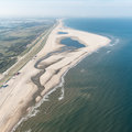
Sand is the second most widely used raw material in the world, after water. Sand dunes keep our country safe from flooding.
30 November 2019
Sinking sea water and rising sea level
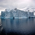
In 2014 Caroline Katsman was awarded a Vidi grant to conduct research into the influence of ocean whirls on surface water sinking. How is she getting on two (and a bit) years later? ‘2017 is going to be a bumper year, with a number of new papers in the pipeline,’ Katsman says.
25 November 2019
BRIGAID: Solutions for extreme climate events
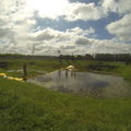
Climate scientists are predicting an increase in droughts, floods and other extreme weather events as a result of continuing global warming. BRIGAID (Bridging the gap for Innovations in Disaster Resilience), an ambitious programme initiated by a partnership of European universities, research institutes and businesses in May of this year, is aimed at finding innovative ways of coping with the increased likelihood of natural disasters of this kind. Bas Jonkman (39), Professor of Integral Hydraulic Engineering at TU Delft’s faculty of Civil Engineering and Geosciences will be heading this multifaceted programme for the next four years.
21 November 2019
Measuring the waves with a smartphone
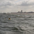
An affordable wave buoy that's easy to transport and shows everything it measures right away via an app. That's what Max Radermacher dreamt of when he was using bulky heavy instruments to collect data about wave currents for his PhD research at TU Delft. Since then, he and his partner have developed the WaveDroid – a wave buoy that meets all his personal requirements. And now it's time to demonstrate its potential to the world.
17 November 2019
10,000 plastic plants in the waterlab
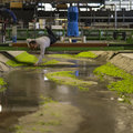
A river flows through the main channel of the waterlab full of little, green plastic plants. PhD Andrés Vargas uses this set up to study how rivers behave. What determines their shape? If you know that, you can arrive at better decisions for the cities and land located along the river. For example, where is the best place to build a bridge? And what effect does that have on the river and the surrounding land?
15 November 2019
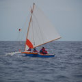
Reading the waves
The native people of the Marshall Islands were able to find their way safely from one island to another by reading the waves, even when hundreds of kilometres separated them from the welcome sight of a friendly shore. Having neither compass nor gps, they almost always managed to get to where they set out to be. Gerbrant van Vledder, oceanographer at TU Delft, was intrigued and wanted to know how they did it. Accompanied by two fellow scientists he followed a Marshallese sailboat in order to study and preserve the ancient art of wave pattern navigation.